
File:Grossraum Basel.png
Size o this luikower: 800 × 571 pixels. Ither resolutions: 320 × 228 pixels | 640 × 457 pixels | 1,024 × 731 pixels | 1,280 × 914 pixels | 1,486 × 1,061 pixels.
Oreeginal file (1,486 × 1,061 pixels, file size: 1.28 MB, MIME type: image/png)

|
File:Grossraum Basel.svg is a vector version o this file. It should be uised in place o this raster image when nae inferior.
File:Grossraum Basel.png → File:Grossraum Basel.svg
For mair information, see Help:SVG. |
 |
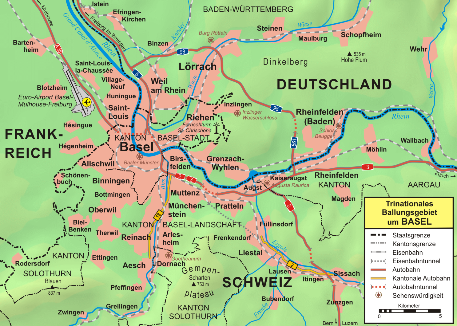
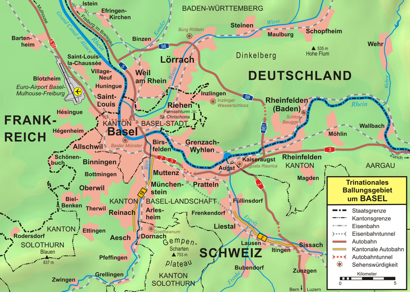
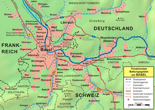
| Descreeption | Topographische Karte vom Großraum Basel |
| Date | |
| Soorce |
own work, used:
|
| Author | first version by Wladyslaw Sojka, complete reworked version by Lencer |
| Other versions | SVG-Version |

|
This map has been made or improved in the German Kartenwerkstatt (Map Lab). You can propose maps to improve as well.
|
This file is licensed unner the Creative Commons Attribution-Share Alike 3.0 Unported license.
- Ye are free:
- tae share – tae copy, distribute an transmit the wirk
- tae remix – tae adapt the wirk
- Unner the follaein condeetions:
- attribution – Ye must attribute the wirk in the manner specified bi the author or licensor (but nae in ony way that suggests that thay endorse ye or yer uise o the wirk).
- share alik – If ye alter, transform, or big upon this wirk, ye mey distribute the resultin wirk anly unner the same or seemilar license tae this ane.
File history
Clap oan ae date/time fer tae see the file aes it kithed at that time.
| Date/Time | Thummnail | Dimensions | Uiser | Comment | |
|---|---|---|---|---|---|
| current | 15:34, 21 October 2012 | | 1,486 × 1,061 (1.28 MB) | Ras67 | cropped |
| 19:40, 19 October 2007 |  | 1,500 × 1,075 (1.29 MB) | Lencer | ||
| 16:16, 18 October 2007 |  | 1,500 × 1,075 (1.41 MB) | Lencer | ||
| 15:38, 18 October 2007 |  | 1,500 × 1,074 (1.41 MB) | Lencer | {{Information| |Description=Topographische Karte vom Großraum Basel |Source=own work, used: * [http://www.maps-for-free.com/ Google Maps-For-Free] SRTM3 Webserver * [http://www.openstreetmap.org/index.html OpenStreetMap] Webserver * [http: | |
| 16:59, 24 December 2006 |  | 2,068 × 1,422 (1.99 MB) | W-j-s | {{Information |Description=''no original description'' |Source=Originally from [http://de.wikipedia.org de.wikipedia]; description page is/was [http://de.wikipedia.org/w/index.php?title=Image%3AGrossraum_Basel.png here]. |Date=2006-09-04 (first version); |
Eimage airtins
The'r nae pages airts tae this eimage.
Global file uisage
The follaein ither wikis uise this file:
- Uisage on als.wikipedia.org
- Uisage on azb.wikipedia.org
- Uisage on be.wikipedia.org
- Uisage on bg.wikipedia.org
- Uisage on cs.wikipedia.org
- Uisage on cv.wikipedia.org
- Uisage on de.wikipedia.org
- Portal:Basel
- Wikipedia:Fotowerkstatt/Archiv 4
- Benutzer Diskussion:DemonDeLuxe
- Benutzer:Lencer
- Benutzer:Lencer/Galerie
- Benutzer:Mathetes/Portal Basel
- Benutzer:Walti us rieche/riehen
- Wikipedia:Kartenwerkstatt/Archiv/2007-10
- Wikipedia:Kandidaten für exzellente Bilder/Archiv2007/16
- Wikipedia:Kartenwerkstatt/Archiv/2008-03
- Benutzer:Lencer/Unterseite
- Wikipedia:Kandidaten für exzellente Bilder/Archiv2011/2
- Uisage on en.wikipedia.org
- Uisage on eo.wikipedia.org
- Uisage on es.wikipedia.org
- Uisage on eu.wikipedia.org
- Uisage on fr.wikipedia.org
- Uisage on hu.wikipedia.org
- Uisage on hy.wikipedia.org
- Uisage on it.wikipedia.org
- Uisage on kk.wikipedia.org
- Uisage on la.wikipedia.org
- Uisage on nds.wikipedia.org
- Uisage on nl.wikipedia.org
- Uisage on no.wikipedia.org
- Uisage on pl.wikipedia.org
View mair global usage o this file.