
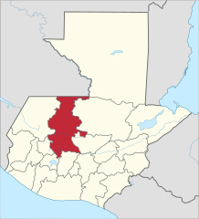
File:El Quiche in Guatemala.svg

Size of this PNG preview of this SVG file: 545 × 599 pixels. Ither resolutions: 218 × 240 pixels | 436 × 480 pixels | 698 × 768 pixels | 931 × 1,024 pixels | 1,862 × 2,048 pixels | 982 × 1,080 pixels.
Oreeginal file (SVG file, nominallie 982 × 1,080 pixels, file size: 237 KB)
Ootline
.svg)
.svg)
.svg)
.svg)
.svg)
.svg)
.svg)

-en.svg)

.svg)
.svg)
.svg)

_(US48).svg)
_(small_islands_magnified)_(-mini_map_-rivers).svg)
.svg)
_(extra_close)_(US48).svg)
.svg)
_(zoom).svg)

.svg)


_(UNMIK).svg)
.svg)
_(disputed_hatched).svg)
_(claimed_and_disputed_hatched).svg)
.svg)
.svg)
_(%2Ball_claims_hatched).svg)

.svg)
_(shade).svg)
_(shade)_(special_marker).svg)
_(-mini_map).svg)
_(-mini_map).svg)
_(-mini_map).svg)


.svg)

.svg)
Licensin
I, the copyright holder of this work, hereby publish it under the following license:
This file is licensed under the Creative Commons Attribution 3.0 Unported license.
- Ye are free:
- tae share – tae copy, distribute an transmit the wirk
- tae remix – tae adapt the wirk
- Unner the follaein condeetions:
- attribution – Ye must attribute the wirk in the manner specified bi the author or licensor (but nae in ony way that suggests that thay endorse ye or yer uise o the wirk).

|
I'd greatly appreciate, that you attribute this media file to Wikimedia Commons, if used outside Wikipedia or Commons. For use in publications such as books, newspapers, blogs, websites, please insert here the following line:
|
File history
Clap oan ae date/time fer tae see the file aes it kithed at that time.
| Date/Time | Thummnail | Dimensions | Uiser | Comment | |
|---|---|---|---|---|---|
| current | 07:48, 10 December 2012 | | 982 × 1,080 (237 KB) | Profoss | |
| 07:44, 10 December 2012 |  | 982 × 1,080 (237 KB) | Profoss | Fixed a slight colouring error. | |
| 11:34, 4 November 2011 |  | 982 × 1,080 (235 KB) | TUBS |
Eimage airtins
The follaein pages airts tae this image:
Global file uisage
The follaein ither wikis uise this file:
- Uisage on ar.wikipedia.org
- Uisage on ay.wikipedia.org
- Uisage on bg.wikipedia.org
- Uisage on bs.wikipedia.org
- Uisage on ca.wikipedia.org
- Uisage on de.wikipedia.org
- Uisage on en.wikipedia.org
- Flag of Guatemala
- Quiché Department
- Departments of Guatemala
- Santa Cruz del Quiché
- Chichicastenango
- Canillá
- Chajul
- Chicamán
- Chiché, Guatemala
- Chinique
- Cunén
- Joyabaj
- Santa Maria Nebaj
- Sacapulas
- Patzité
- Pachalum
- Playa Grande, Guatemala
- San Andrés Sajcabajá
- San Antonio Ilotenango
- San Bartolomé Jocotenango
- San Pedro Jocopilas
- San Juan Cotzal
- Zacualpa
- Uspantán
- Wikipedia:WikiProject Guatemala/Department templates
- Template:Quiché Department
- Module:Location map/data/Guatemala Quiché
- Module:Location map/data/Guatemala Quiché/doc
- Module:Location map/data/Guatemala El Quiché
- Uisage on eo.wikipedia.org
- Uisage on es.wikipedia.org
View mair global usage o this file.