
File:Donrivermap.png
Size o this luikower: 595 × 599 pixels. Ither resolutions: 238 × 240 pixels | 477 × 480 pixels | 1,000 × 1,007 pixels.
Oreeginal file (1,000 × 1,007 pixels, file size: 209 KB, MIME type: image/png)

|
This map image could be re-created using vector graphics as an SVG file. This has several advantages; see Commons:Media for cleanup for more information. If an SVG form of this image is available, please upload it and afterwards replace this template with
{{vector version available|new image name}}.
It is recommended to name the SVG file “Donrivermap.svg”—then the template Vector version available (or Vva) does not need the new image name parameter. |
Ootline
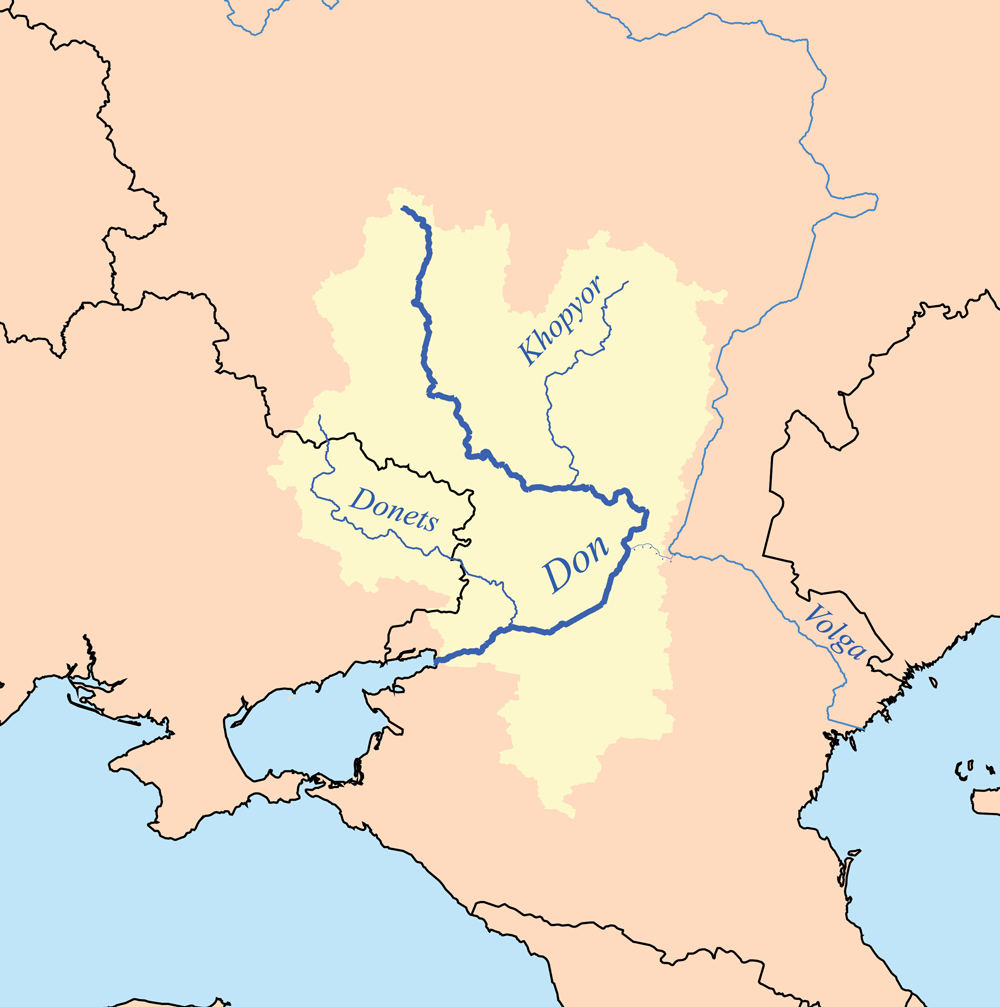
| Descreeption | This is a map of the Don and Donets rivers. I, Karl Musser, created it based on USGS data. |
| Date | 18 September 2006 (original upload date) |
| Soorce | No machine-readable source provided. Own work assumed (based on copyright claims). |
| Author | No machine-readable author provided. Kmusser assumed (based on copyright claims). |
Licensin
I, the copyright holder of this work, hereby publish it under the following license:
This file is licensed under the Creative Commons Attribution-Share Alike 2.5 Generic license.
- Ye are free:
- tae share – tae copy, distribute an transmit the wirk
- tae remix – tae adapt the wirk
- Unner the follaein condeetions:
- attribution – Ye must attribute the wirk in the manner specified bi the author or licensor (but nae in ony way that suggests that thay endorse ye or yer uise o the wirk).
- share alik – If ye alter, transform, or big upon this wirk, ye mey distribute the resultin wirk anly unner the same or seemilar license tae this ane.
File history
Clap oan ae date/time fer tae see the file aes it kithed at that time.
| Date/Time | Thummnail | Dimensions | Uiser | Comment | |
|---|---|---|---|---|---|
| current | 19:32, 2 Februar 2013 | | 1,000 × 1,007 (209 KB) | Kmusser | Upped resolution, added Khopyor |
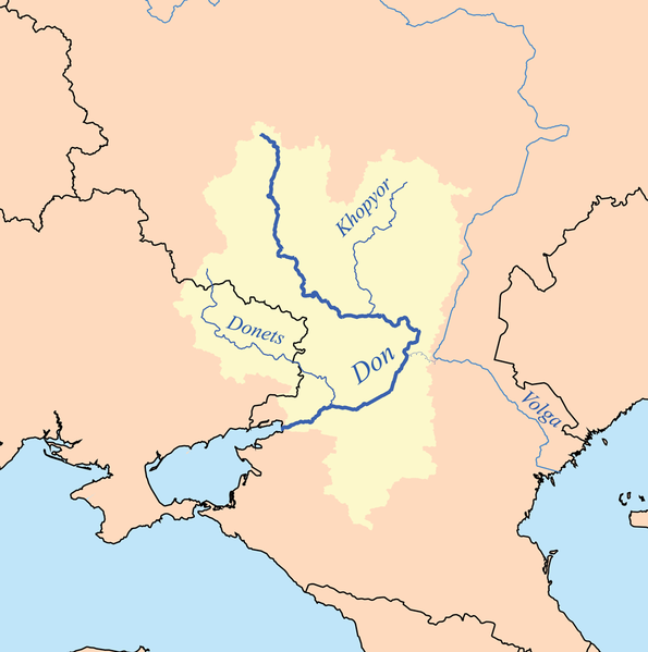
| 23:15, 18 September 2006 |  | 400 × 403 (66 KB) | Kmusser | This is a map of the Don and Donets rivers. I, Karl Musser, created it based on USGS data. {{self|cc-by-sa-2.5}} Category:Maps of rivers |
Eimage airtins
The'r nae pages airts tae this eimage.
Global file uisage
The follaein ither wikis uise this file:
- Uisage on af.wikipedia.org
- Uisage on am.wikipedia.org
- Uisage on ar.wikipedia.org
- Uisage on arz.wikipedia.org
- Uisage on ast.wikipedia.org
- Uisage on be-tarask.wikipedia.org
- Uisage on be.wikipedia.org
- Uisage on bh.wikipedia.org
- Uisage on bn.wikipedia.org
- Uisage on bo.wikipedia.org
- Uisage on bs.wikipedia.org
- Uisage on ca.wikipedia.org
- Uisage on ceb.wikipedia.org
- Uisage on cs.wikipedia.org
- Uisage on cy.wikipedia.org
- Uisage on da.wikipedia.org
- Uisage on de.wikipedia.org
- Uisage on dsb.wikipedia.org
- Uisage on en.wikipedia.org
- Uisage on eo.wikipedia.org
- Uisage on eo.wiktionary.org
- Uisage on es.wikipedia.org
- Uisage on et.wikipedia.org
- Uisage on fa.wikipedia.org
- Uisage on fi.wikipedia.org
View mair global usage o this file.