
File:Didsbury Village 20-02-2005.jpg

Size o this luikower: 749 × 600 pixels. Ither resolutions: 300 × 240 pixels | 600 × 480 pixels | 959 × 768 pixels | 1,234 × 988 pixels.
Oreeginal file (1,234 × 988 pixels, file size: 293 KB, MIME type: image/jpeg)
Ootline
| Descreeption |
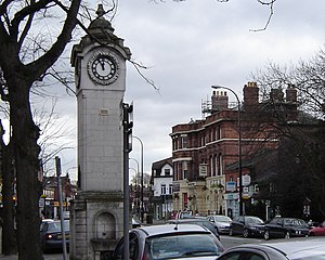
English: Wilmslow Road in Didsbury Village, Manchester, with the clock tower in the foreground. |
| Date | |
| Soorce | Ain wirk |
| Author | Joanna Driscoll |
| Camera location | | View this and other nearby images on: OpenStreetMap |
|---|
Licensin
This file is licensed under the Creative Commons Attribution-Share Alike 2.0 Generic license.
- Ye are free:
- tae share – tae copy, distribute an transmit the wirk
- tae remix – tae adapt the wirk
- Unner the follaein condeetions:
- attribution – Ye must attribute the wirk in the manner specified bi the author or licensor (but nae in ony way that suggests that thay endorse ye or yer uise o the wirk).
- share alik – If ye alter, transform, or big upon this wirk, ye mey distribute the resultin wirk anly unner the same or seemilar license tae this ane.
File history
Clap oan ae date/time fer tae see the file aes it kithed at that time.
| Date/Time | Thummnail | Dimensions | Uiser | Comment | |
|---|---|---|---|---|---|
| current | 19:13, 20 Februar 2005 | | 1,234 × 988 (293 KB) | Tasiel~commonswiki | Didsbury Village |
Eimage airtins
The'r nae pages airts tae this eimage.
Global file uisage
The follaein ither wikis uise this file:
- Uisage on en.wikipedia.org
- Uisage on fr.wikipedia.org
- Uisage on nl.wikipedia.org
- Uisage on simple.wikipedia.org