
File:Dakar districts.svg

Size of this PNG preview of this SVG file: 260 × 260 pixels. Ither resolutions: 240 × 240 pixels | 480 × 480 pixels | 768 × 768 pixels | 1,024 × 1,024 pixels | 2,048 × 2,048 pixels.
Oreeginal file (SVG file, nominallie 260 × 260 pixels, file size: 100 KB)
Ootline
| Descreeption |
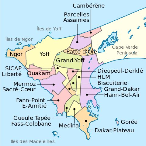
English: Dakar districts map |
| Date | |
| Soorce | Ain wirk |
| Author | Mikima |
| Other versions |
|

| Camera location | | View this and other nearby images on: OpenStreetMap |
|---|
Licensin
I, the copyright holder of this work, hereby publish it under the following license:
This file is licensed unner the Creative Commons Attribution-Share Alike 3.0 Unported license.
- Ye are free:
- tae share – tae copy, distribute an transmit the wirk
- tae remix – tae adapt the wirk
- Unner the follaein condeetions:
- attribution – Ye must attribute the wirk in the manner specified bi the author or licensor (but nae in ony way that suggests that thay endorse ye or yer uise o the wirk).
- share alik – If ye alter, transform, or big upon this wirk, ye mey distribute the resultin wirk anly unner the same or seemilar license tae this ane.
File history
Clap oan ae date/time fer tae see the file aes it kithed at that time.
| Date/Time | Thummnail | Dimensions | Uiser | Comment | |
|---|---|---|---|---|---|
| current | 12:56, 25 October 2013 | | 260 × 260 (100 KB) | Mikima | Typos |
| 11:08, 25 October 2013 |  | 260 × 260 (100 KB) | Mikima | font update | |
| 10:53, 25 October 2013 |  | 260 × 260 (100 KB) | Mikima | Font properly setted | |
| 10:52, 25 October 2013 |  | 260 × 260 (100 KB) | Mikima | Reverted to version as of 10:28, 25 October 2013 - font not properly setted | |
| 10:39, 25 October 2013 |  | 260 × 260 (100 KB) | Mikima | Updated fonts according to https://meta.wikimedia.org/wiki/SVG_fonts, used DejaVu | |
| 10:28, 25 October 2013 |  | 260 × 260 (100 KB) | Mikima | Added a layer of color-coded regions, according to wikipedia main used colors. | |
| 02:33, 25 October 2013 |  | 260 × 260 (45 KB) | Mikima | Updated colors to match other maps style | |
| 02:25, 25 October 2013 |  | 260 × 260 (44 KB) | Mikima | Optimized for low resolution | |
| 01:59, 25 October 2013 |  | 2,000 × 2,000 (44 KB) | Mikima | User created page with UploadWizard |
Eimage airtins
The follaein pages airts tae this image:
Global file uisage
The follaein ither wikis uise this file:
- Uisage on af.wikipedia.org
- Uisage on azb.wikipedia.org
- Uisage on ceb.wikipedia.org
- Uisage on de.wikipedia.org
- Dakar
- Ngor (Dakar)
- Yoff (Dakar)
- Ouakam
- Mermoz-Sacré Cœur
- Fann-Point E-Amitié
- Gueule Tapée-Fass-Colobane
- HLM (Dakar)
- Médina (Dakar)
- Grand Dakar
- Biscuiterie (Dakar)
- Dieuppeul-Derklé
- Sicap-Liberté
- Grand Yoff
- Arrondissement des Almadies
- Arrondissement de Grand Dakar
- Arrondissement de Dakar Plateau
- Arrondissement des Parcelles Assainies
- Patte d’Oie
- Parcelles Assainies
- Cambérène
- Hann-Bel Air
- Dakar Plateau
- Wikipedia:Kartenwerkstatt/Archiv/2019-08
- Uisage on de.wikivoyage.org
- Uisage on en.wikipedia.org
- Uisage on eo.wikipedia.org
- Uisage on fa.wikipedia.org
- Uisage on fr.wikipedia.org
- Uisage on id.wikipedia.org
- Uisage on it.wikipedia.org
- Uisage on it.wikivoyage.org
- Uisage on ja.wikipedia.org
- Uisage on la.wikipedia.org
- Uisage on ms.wikipedia.org
- Uisage on oc.wikipedia.org
- Uisage on ps.wikipedia.org
- Uisage on pt.wikipedia.org
- Uisage on sat.wikipedia.org
- Uisage on sd.wikipedia.org
- Uisage on sh.wikipedia.org
- Uisage on simple.wikipedia.org
- Uisage on th.wikipedia.org
- Uisage on vep.wikipedia.org
- Uisage on vi.wikipedia.org