
File:Corse region location map.svg

Size of this PNG preview of this SVG file: 304 × 600 pixels. Ither resolutions: 121 × 240 pixels | 243 × 480 pixels | 389 × 768 pixels | 519 × 1,024 pixels | 1,038 × 2,048 pixels | 824 × 1,625 pixels.
Oreeginal file (SVG file, nominallie 824 × 1,625 pixels, file size: 191 KB)
Ootline
| Camera location | | View this and other nearby images on: OpenStreetMap |
|---|
| Descreeption |
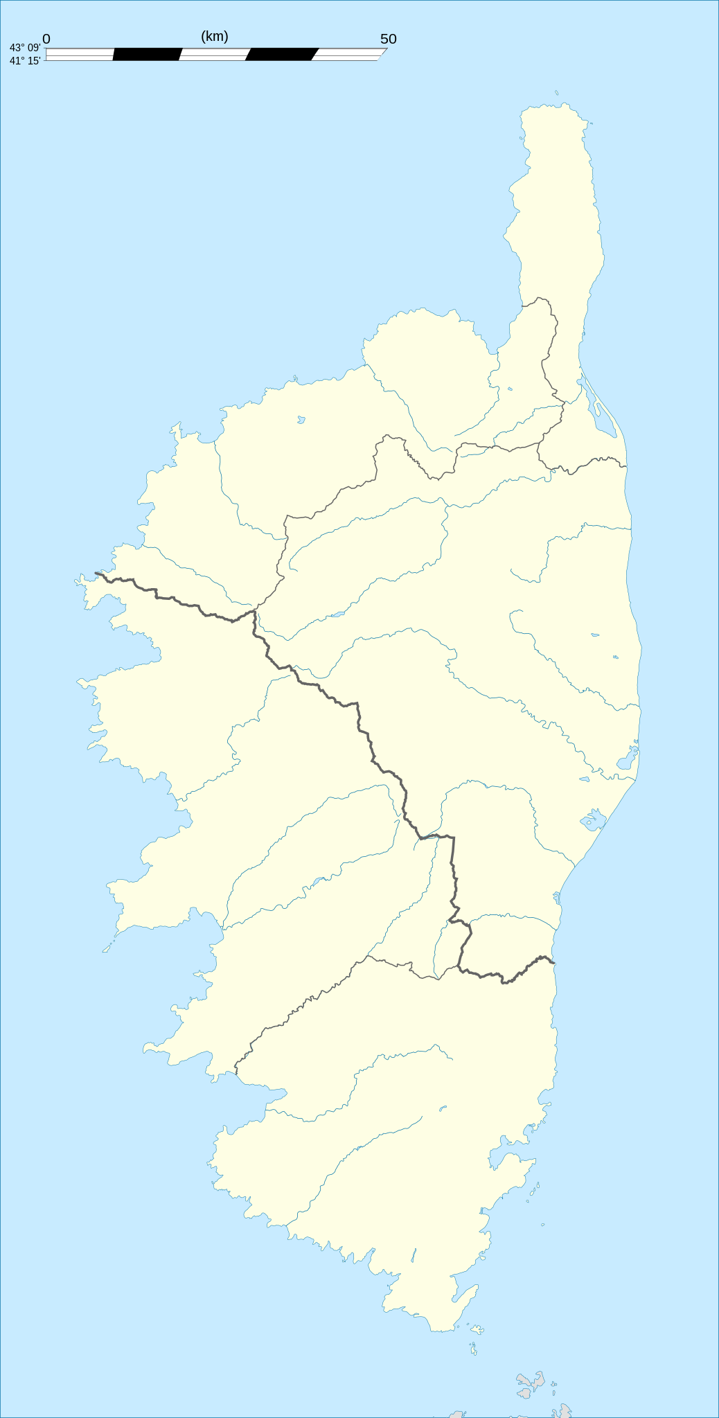
English: Blank administrative map of the region of Corsica, France, for geo-location purpose, with distinct boundaries for departments and arrondissements as they are since January 2010.
The former version of the map shows the boundaries as they were until December 2009. Français : Carte administrative vierge de la région Corse, France, destinée à la géolocalisation, avec limite distincte des départements et arrondissements tels que depuis janvier 2010. L'ancienne version de la carte montre le découpage administratif tel qu'il était jusqu'en décembre 2009. Equirectangular projection, WGS84 datum
Geographic limits of the map:
|
||
| Date | 2008-08, modified 02-2010 | ||
| Soorce |
Ain wirk
|
||
| Author | Eric Gaba (Sting - fr:Sting) | ||
| Permission (Reuisin this file) |
|
||
| Other versions |
|

Licensin
I, the copyright holder of this work, hereby publish it under the following licenses:
This file is licensed unner the Creative Commons Attribution-Share Alike 3.0 Unported license.
- Ye are free:
- tae share – tae copy, distribute an transmit the wirk
- tae remix – tae adapt the wirk
- Unner the follaein condeetions:
- attribution – Ye must attribute the wirk in the manner specified bi the author or licensor (but nae in ony way that suggests that thay endorse ye or yer uise o the wirk).
- share alik – If ye alter, transform, or big upon this wirk, ye mey distribute the resultin wirk anly unner the same or seemilar license tae this ane.

|
Permission is grantit tae copy, distribute an/or modify this document unner the terms o the GNU Free Documentation License, Version 1.2 or ony later version published bi the Free Software Foundation; wi no Invariant Sections, no Front-Cover Texts, an no Back-Cover Texts. A copy o the license is includit in the section enteetled GNU Free Documentation License. |
Ye mey select the license o yer choice.
File history
Clap oan ae date/time fer tae see the file aes it kithed at that time.
| Date/Time | Thummnail | Dimensions | Uiser | Comment | |
|---|---|---|---|---|---|
| current | 21:21, 27 September 2015 | | 824 × 1,625 (191 KB) | Iowajason | Edited SVG language to remove two local file path references. These SVG attributes were flagged by other wikis as insecure when trans-wiki'd. No change to substantive content. Submitted as a minor edit, with all licenses to reflect those of the prior v... |
| 19:29, 22 Februar 2010 |  | 824 × 1,625 (191 KB) | Sting | Updated arrondissements boundaries of Haute-Corse | |
| 19:52, 14 August 2008 |  | 824 × 1,625 (209 KB) | Sting | == Summary == {{Location|42|12|00|N|09|03|00|E|scale:2000000}} <br/> {{Information |Description={{en|Blank administrative map of the region of Corsica, France, for geo-location purpose, with distinct boundaries for departments and arrondis |
Eimage airtins
The follaein pages airts tae this image:
Global file uisage
The follaein ither wikis uise this file:
- Uisage on als.wikipedia.org
- Uisage on ar.wikipedia.org
- Uisage on ast.wikipedia.org
- Uisage on azb.wikipedia.org
- Uisage on bg.wikipedia.org
- Uisage on bn.wikipedia.org
- Uisage on bs.wikipedia.org
- Uisage on ca.wikipedia.org
- Uisage on ceb.wikipedia.org
- Uisage on cs.wikipedia.org
- Uisage on da.wikipedia.org
- Uisage on de.wikipedia.org
- Alistro
- Filitosa
- Porto (Korsika)
- L’Ospédale
- Castellu di Cucuruzzu
- Torre von Ceccia
- Vorlage:Positionskarte Frankreich Korsika
- Wikipedia:Kartenwerkstatt/Positionskarten/Europa
- Monument von Alo-Bisucce
- Vorlage Diskussion:Infobox Gemeinde in Frankreich/Archiv/2008
- Torre von Tappa
- Torre von Torre
- Ponte Novu
- Uisage on de.wikivoyage.org
- Uisage on dsb.wikipedia.org
- Uisage on el.wikipedia.org
- Uisage on en.wikipedia.org
View mair global usage o this file.