
File:Cheltenham UK locator map.svg

Size of this PNG preview of this SVG file: 516 × 600 pixels. Ither resolutions: 206 × 240 pixels | 413 × 480 pixels | 661 × 768 pixels | 881 × 1,024 pixels | 1,762 × 2,048 pixels | 1,089 × 1,266 pixels.
Oreeginal file (SVG file, nominallie 1,089 × 1,266 pixels, file size: 1.09 MB)
| Descreeption |
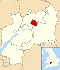
Map of Gloucestershire, UK with Cheltenham highlighted. Equirectangular map projection on WGS 84 datum, with N/S stretched 160% |
| Date | |
| Soorce |
|
| Author | Nilfanion, created using Ordnance Survey data |
| Permission (Reuisin this file) |
This file is licensed unner the Creative Commons Attribution-Share Alike 3.0 Unported license. Attribution: Contains Ordnance Survey data © Crown copyright and database right
|
File history
Clap oan ae date/time fer tae see the file aes it kithed at that time.
| Date/Time | Thummnail | Dimensions | Uiser | Comment | |
|---|---|---|---|---|---|
| current | 12:23, 27 Februar 2011 | | 1,089 × 1,266 (1.09 MB) | Nilfanion | {{Information |Description=Map of Gloucestershire, UK with Cheltenham highlighted. Equirectangular map projection on WGS 84 datum, with N/S stretched 160% |Source=Ordnance Survey [https://www.o |
Eimage airtins
The'r nae pages airts tae this eimage.
Global file uisage
The follaein ither wikis uise this file:
- Uisage on ar.wikipedia.org
- Uisage on arz.wikipedia.org
- Uisage on azb.wikipedia.org
- Uisage on bg.wikipedia.org
- Uisage on ca.wikipedia.org
- Uisage on cy.wikipedia.org
- Uisage on el.wikipedia.org
- Uisage on en.wikipedia.org
- Uisage on fa.wikipedia.org
- Uisage on fi.wikipedia.org
- Uisage on fr.wikipedia.org
- Uisage on ga.wikipedia.org
- Uisage on hy.wikipedia.org
- Uisage on ja.wikipedia.org
- Uisage on nl.wikipedia.org
- Uisage on no.wikipedia.org
- Uisage on pl.wikipedia.org
- Uisage on pt.wikipedia.org
- Uisage on ru.wikipedia.org
- Uisage on simple.wikipedia.org
- Uisage on sv.wikipedia.org
- Uisage on th.wikipedia.org
- Uisage on tr.wikipedia.org
- Uisage on tt.wikipedia.org
- Uisage on ur.wikipedia.org
- Uisage on vo.wikipedia.org
- Uisage on www.wikidata.org
- Uisage on zh-min-nan.wikipedia.org
- Uisage on zh.wikipedia.org