
File:Bouvet Map.png
Size o this luikower: 787 × 600 pixels. Ither resolutions: 315 × 240 pixels | 630 × 480 pixels | 1,008 × 768 pixels | 1,280 × 975 pixels | 2,560 × 1,950 pixels | 2,804 × 2,136 pixels.
Oreeginal file (2,804 × 2,136 pixels, file size: 876 KB, MIME type: image/png)
| Descreeption |
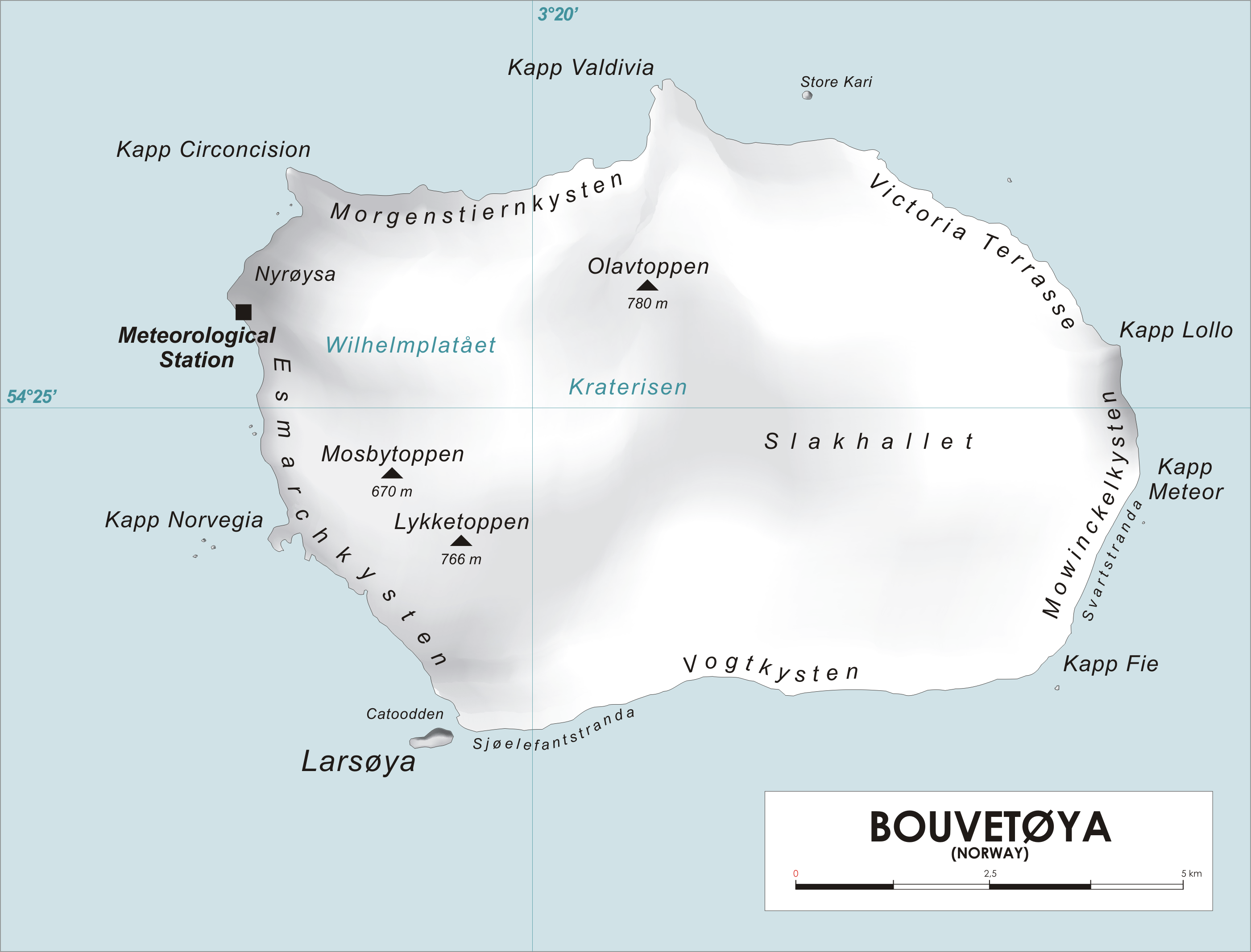
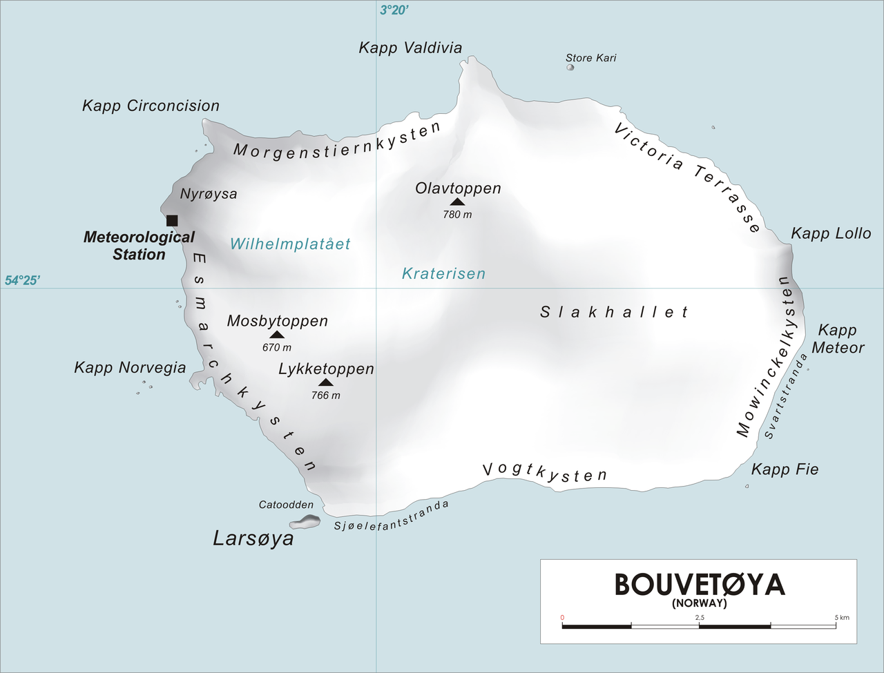
English: Map of Bouvet Island, Southern Atlantic Ocean Norsk bokmål: Kart over Bouvetøya, Sør-Atlanten |
| Soorce | Ain wirk |
| Author | varp |
| I, the copyright holder of this work, release this work into the public domain. This applies worldwide. In some countries this may not be legally possible; if so: I grant anyone the right to use this work for any purpose, without any conditions, unless such conditions are required by law. |
File history
Clap oan ae date/time fer tae see the file aes it kithed at that time.
| Date/Time | Thummnail | Dimensions | Uiser | Comment | |
|---|---|---|---|---|---|
| current | 12:25, 28 Apryle 2006 | | 2,804 × 2,136 (876 KB) | Varp~commonswiki | *Map of Bouvet Island, Southern Atlantic Ocean *drawn by varp |
Eimage airtins
The follaein pages airts tae this image:
Global file uisage
The follaein ither wikis uise this file:
- Uisage on als.wikipedia.org
- Uisage on ar.wikipedia.org
- Uisage on arz.wikipedia.org
- Uisage on ba.wikipedia.org
- Uisage on ca.wikipedia.org
- Uisage on ceb.wikipedia.org
- Uisage on cs.wikipedia.org
- Uisage on cy.wikipedia.org
- Uisage on da.wikipedia.org
- Uisage on de.wikipedia.org
- Uisage on de.wikivoyage.org
- Uisage on el.wikipedia.org
- Uisage on en.wikipedia.org
View mair global usage o this file.