
File:Austria Carinthia location map.svg

Size of this PNG preview of this SVG file: 800 × 472 pixels. Ither resolutions: 320 × 189 pixels | 640 × 378 pixels | 1,024 × 604 pixels | 1,280 × 755 pixels | 2,560 × 1,511 pixels | 1,342 × 792 pixels.
Oreeginal file (SVG file, nominallie 1,342 × 792 pixels, file size: 932 KB)
Ootline
| Descreeption |
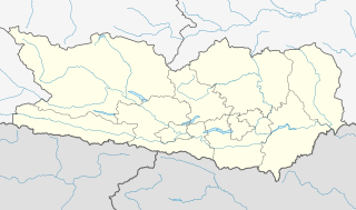
Deutsch: Positionskarte von Kärnten.
Quadratische Plattkarte. Geographische Begrenzung der Karte:
English: Location map of Carinthia.
Equirectangular projection. Geographic limits of the map:
|
| Date | |
| Soorce |
Own work, based on maps-for-free.com and File:Gemeinden Kärnten.svg This W3C-unspecified vector image was created with Inkscape . |
| Author | Rosso Robot, versions later 2013-10: NordNordWest |
| Other versions |
|

Licensin
I, the copyright holder of this work, hereby publish it under the following licenses:
This file is licensed unner the Creative Commons Attribution-Share Alike 3.0 Unported license.
- Ye are free:
- tae share – tae copy, distribute an transmit the wirk
- tae remix – tae adapt the wirk
- Unner the follaein condeetions:
- attribution – Ye must attribute the wirk in the manner specified bi the author or licensor (but nae in ony way that suggests that thay endorse ye or yer uise o the wirk).
- share alik – If ye alter, transform, or big upon this wirk, ye mey distribute the resultin wirk anly unner the same or seemilar license tae this ane.

|
Permission is grantit tae copy, distribute an/or modify this document unner the terms o the GNU Free Documentation License, Version 1.2 or ony later version published bi the Free Software Foundation; wi no Invariant Sections, no Front-Cover Texts, an no Back-Cover Texts. A copy o the license is includit in the section enteetled GNU Free Documentation License. |
Ye mey select the license o yer choice.
File history
Clap oan ae date/time fer tae see the file aes it kithed at that time.
| Date/Time | Thummnail | Dimensions | Uiser | Comment | |
|---|---|---|---|---|---|
| current | 17:31, 6 October 2013 | | 1,342 × 792 (932 KB) | NordNordWest | corr |
| 16:55, 6 October 2013 |  | 1,342 × 792 (926 KB) | NordNordWest | projection corrected | |
| 11:53, 27 Mey 2009 |  | 848 × 389 (59 KB) | Rosso Robot | colour correction | |
| 20:42, 26 Mey 2009 |  | 848 × 389 (58 KB) | Rosso Robot | drau correction | |
| 18:44, 26 Mey 2009 |  | 848 × 389 (58 KB) | Rosso Robot | Reverted to version as of 18:38, 26 May 2009 | |
| 18:40, 26 Mey 2009 |  | 848 × 389 (58 KB) | Rosso Robot | plain svg | |
| 18:38, 26 Mey 2009 |  | 848 × 389 (58 KB) | Rosso Robot | {{Information |Description={{de|1=Positionskarte von Kärnten}} Quadratische Plattkarte. Geographische Begrenzung der Karte: * N: 47.13836° N * S: 46.36446° N * W: 12.62604° O * O: 15.08457° O}} {{en|1=Location map of [[:en |
Eimage airtins
The follaein pages airts tae this image:
Global file uisage
The follaein ither wikis uise this file:
- Uisage on ba.wikipedia.org
- Uisage on bg.wikipedia.org
- Uisage on cs.wikipedia.org
- Uisage on cv.wikipedia.org
- Uisage on de.wikipedia.org
- Hemmaberg
- Flughafen Klagenfurt
- Talübergang Lavant
- City-Arkaden Klagenfurt
- Eissportzentrum Klagenfurt
- Atrio
- Stadthalle Villach
- Mölltaler Gletscher
- ASK-Sportanlage Fischl
- Wörthersee Stadion
- Wikipedia:Kartenwerkstatt/Positionskarten/Europa
- Diskussion:Penk (Gemeinde Reißeck)
- Falkensteinbrücke
- Pfaffenbergbrücke
- Vorlage:Positionskarte Österreich Kärnten
- Klinikum Klagenfurt am Wörthersee
- Kärntner Eishockey-Derby
- Stadtpark Center Spittal
- Südpark (Einkaufszentrum)
- Affenberg Landskron
- Unfallkrankenhaus Klagenfurt
- Österreichische Fußballmeisterschaft 2012/13
- Skigebiet Großglockner Heiligenblut
- Lavanttal-Arena
- Österreichische Fußballmeisterschaft 2013/14
View mair global usage o this file.