
File:Austin circuit.svg

Size of this PNG preview of this SVG file: 600 × 600 pixels. Ither resolutions: 240 × 240 pixels | 480 × 480 pixels | 768 × 768 pixels | 1,024 × 1,024 pixels | 2,048 × 2,048 pixels | 2,300 × 2,300 pixels.
Oreeginal file (SVG file, nominallie 2,300 × 2,300 pixels, file size: 104 KB)
Ootline
| Descreeption |
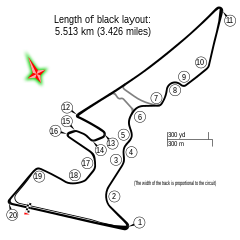
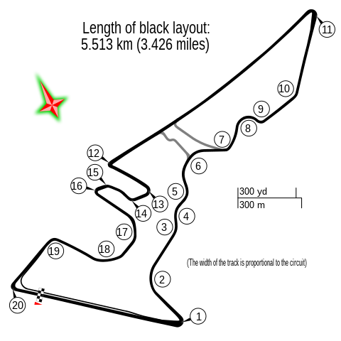
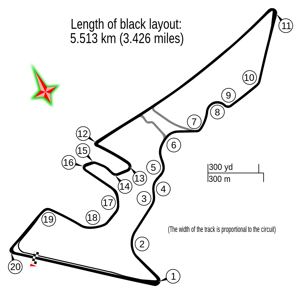
English: Circuit Austin |
| Date | |
| Soorce | Ain wirk |
| Author |
Gustavo Girardelli This W3C-unspecified vector image was created with Inkscape . |
| Other versions |
|
.svg)
| Description |
This map was created from OpenStreetMap project data, collected by the community. This map may be incomplete, and may contain errors. Don't rely solely on it for navigation. |
|||
| Date | (see file history) | |||
| Soorce | openstreetmap.org | |||
| Creator |
OpenStreetMap contributors |
|||
| Permission (Reuisin this file) |
OpenStreetMap data is available under the Open Database License (details). Map tiles are licensed under the Creative Commons Attribution-ShareAlike 2.0 license (CC-BY-SA 2.0).
This file is licensed under the Creative Commons Attribution-Share Alike 2.0 Generic license.
|
|||
| Georeferencing | If inappropriate please set warp_status = skip to hide. |
| Camera location | | View this and other nearby images on: OpenStreetMap |
|---|
File history
Clap oan ae date/time fer tae see the file aes it kithed at that time.
| Date/Time | Thummnail | Dimensions | Uiser | Comment | |
|---|---|---|---|---|---|
| current | 10:06, 27 Apryle 2022 | | 2,300 × 2,300 (104 KB) | DeFacto | Replaced "mi" with "miles" as that abbreviation is not in common use, especially in British English |
| 12:19, 24 October 2017 |  | 2,300 × 2,300 (103 KB) | Cherkash | decimal point instead of comma | |
| 06:10, 22 October 2017 |  | 2,300 × 2,300 (103 KB) | Cherkash | removed a strange artifact in rendering | |
| 05:56, 22 October 2017 |  | 2,300 × 2,300 (103 KB) | Cherkash | fixed length, removed unnecessary text | |
| 06:29, 16 October 2014 |  | 2,300 × 2,300 (109 KB) | Gustavo Girardelli | User created page with UploadWizard |
Eimage airtins
The'r nae pages airts tae this eimage.
Global file uisage
The follaein ither wikis uise this file:
- Uisage on af.wikipedia.org
- Verenigde State Grand Prix
- Lys van Formule Een-bane
- Circuit of the Americas
- 2015 Verenigde State Grand Prix
- 2014 Verenigde State Grand Prix
- 2013 Verenigde State Grand Prix
- 2016 Verenigde State Grand Prix
- 2017 Verenigde State Grand Prix
- 2018 Verenigde State Grand Prix
- 2019 Verenigde State Grand Prix
- 2021 Verenigde State Grand Prix
- 2022 Verenigde State Grand Prix
- 2023 Verenigde State Grand Prix
- Uisage on ar.wikipedia.org
- حلبة الأمريكتين
- جائزة الولايات المتحدة الكبرى 2015
- جائزة الولايات المتحدة الكبرى 2014
- جائزة الولايات المتحدة الكبرى 2013
- جائزة الولايات المتحدة الكبرى 2017
- جائزة الولايات المتحدة الكبرى 2016
- جائزة الولايات المتحدة الكبرى 2018
- جائزة الولايات المتحدة الكبرى 2012
- جائزة الولايات المتحدة الكبرى 2019
- جائزة الولايات المتحدة الكبرى
- جائزة الولايات المتحدة الكبرى 2021
- جائزة الولايات المتحدة الكبرى 2022
- جائزة الولايات المتحدة الكبرى 2023
- Uisage on ast.wikipedia.org
- Uisage on bg.wikipedia.org
- Uisage on bn.wikipedia.org
- Uisage on br.wikipedia.org
- Uisage on bs.wikipedia.org
View mair global usage o this file.