
File:Arrondissement Brussels-Periphery Belgium Map.PNG
Nae heier resolution available.
Arrondissement_Brussels-Periphery_Belgium_Map.PNG (270 × 203 pixels, file size: 5 KB, MIME type: image/png)
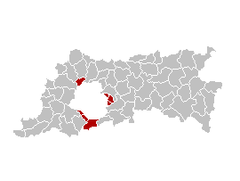
English: Map of the former Arrondissement of Brussels-Periphery in the Province of Flemish Brabant, Belgium.
Nederlands: Kaart van het voormalige arrondissement Brussel-Randgemeenten in de provincie Vlaams-Brabant.
Français : Carte indiquant la localisation de l'ancien arronddissement de Bruxelles-Périphérie dans la Province de Brabant-Flamand.
| This work has been released into the public domain by its author, Ganchelkas. This applies worldwide. In some countries this may not be legally possible; if so: |
I changed the colors of this map, based on the work of w:nl:Gebruiker:LennartBolks/kaartenhoekje, which is also in the public domain.
File history
Clap oan ae date/time fer tae see the file aes it kithed at that time.
| Date/Time | Thummnail | Dimensions | Uiser | Comment | |
|---|---|---|---|---|---|
| current | 13:45, 31 Mairch 2007 | | 270 × 203 (5 KB) | Ganchelkas~commonswiki | {{en|Map of the former Arrondissement of Brussels-Periphery in the Province of Flemish Brabant, Belgium.}} {{nl|Kaart van het voormalige arrondissement Brussel-Randgemeenten in de provincie Vlaams-Brabant.}} {{fr|Carte indiquant la localisation de l'ancie |
Eimage airtins
The follaein pages airts tae this image:
Global file uisage
The follaein ither wikis uise this file:
- Uisage on ar.wikipedia.org
- Uisage on ast.wikipedia.org
- Uisage on ca.wikipedia.org
- Uisage on de.wikipedia.org
- Uisage on en.wikipedia.org
- Uisage on es.wikipedia.org
- Uisage on fr.wikipedia.org
- Uisage on ko.wikipedia.org
- Uisage on nl.wikipedia.org
- Uisage on ro.wikipedia.org
- Uisage on sl.wikipedia.org
- Uisage on vi.wikipedia.org
- Uisage on www.wikidata.org
- Uisage on zh-yue.wikipedia.org
- Uisage on zh.wikipedia.org