
File:American Samoa location map.svg

Size of this PNG preview of this SVG file: 614 × 506 pixels. Ither resolutions: 291 × 240 pixels | 583 × 480 pixels | 932 × 768 pixels | 1,243 × 1,024 pixels | 2,485 × 2,048 pixels.
Oreeginal file (SVG file, nominallie 614 × 506 pixels, file size: 15 KB)
Ootline
| Descreeption |
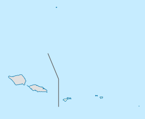
Deutsch: Positionskarte von Amerikanisch-Samoa
Quadratische Plattkarte, N-S-Streckung 102 %. Geographische Begrenzung der Karte:
English: Location map of American Samoa
Equirectangular projection, N/S stretching 102 %. Geographic limits of the map:
|
||
| Date | |||
| Soorce |
Ain wirk, using
|
||
| Author | NordNordWest | ||
| Permission (Reuisin this file) |
I, the copyright holder of this work, hereby publish it under the following license: This file is licensed unner the Creative Commons Attribution-Share Alike 3.0 Unported license.
|
||
| SVG genesis | This locator map was created with Adobe Illustrator by NordNordWest.
|

File history
Clap oan ae date/time fer tae see the file aes it kithed at that time.
| Date/Time | Thummnail | Dimensions | Uiser | Comment | |
|---|---|---|---|---|---|
| current | 19:05, 10 October 2009 | | 614 × 506 (15 KB) | NordNordWest | {{int:filedesc}} {{Information |Description= {{de|Positionskarte von Amerikanisch-Samoa}} Quadratische Plattkarte, N-S-Streckung 102 %. Geographische Begrenzung der Karte: * N: 10.8° S * S: 15.0° S * W: 173.1° W * O: 167.9° |
Eimage airtins
The follaein pages airts tae this image:
Global file uisage
The follaein ither wikis uise this file:
- Uisage on af.wikipedia.org
- Uisage on ar.wikipedia.org
- Uisage on ast.wikipedia.org
- Uisage on azb.wikipedia.org
- Uisage on az.wikipedia.org
- Uisage on ba.wikipedia.org
- Uisage on be-tarask.wikipedia.org
- Uisage on bg.wikipedia.org
- Uisage on bn.wikipedia.org
- Uisage on ceb.wikipedia.org
View mair global usage o this file.