
File:Altiplano map.png

Size o this luikower: 800 × 397 pixels. Ither resolutions: 320 × 159 pixels | 640 × 318 pixels | 1,024 × 508 pixels | 1,600 × 794 pixels.
Oreeginal file (1,600 × 794 pixels, file size: 173 KB, MIME type: image/png)
Ootline
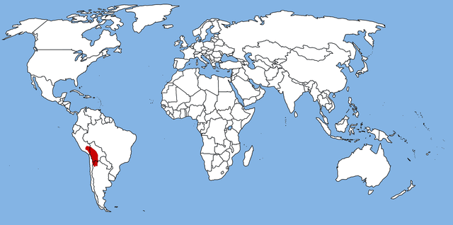
| Descreeption | Altiplato (Andes) |
| Date | Today |
| Soorce | Ain wirk |
| Author | TBjornstad 18:03, 25 November 2006 (UTC) |
| Permission (Reuisin this file) |
PD |
Licensin
| I, the copyright holder of this work, release this work into the public domain. This applies worldwide. In some countries this may not be legally possible; if so: I grant anyone the right to use this work for any purpose, without any conditions, unless such conditions are required by law. |
File history
Clap oan ae date/time fer tae see the file aes it kithed at that time.
| Date/Time | Thummnail | Dimensions | Uiser | Comment | |
|---|---|---|---|---|---|
| current | 07:51, 29 Mairch 2018 | | 1,600 × 794 (173 KB) | Maphobbyist | Montenegro and South Sudan borders |
| 18:03, 25 November 2006 |  | 1,600 × 794 (65 KB) | ToB | {{Information |Description=Altiplato (Andes) |Source=Own work |Date=Today |Author=~~~~ |Permission=PD |other_versions=None }} Category:Andes |
Eimage airtins
The'r nae pages airts tae this eimage.
Global file uisage
The follaein ither wikis uise this file:
- Uisage on ar.wikipedia.org
- Uisage on ca.wikipedia.org
- Uisage on cs.wikipedia.org
- Uisage on da.wikipedia.org
- Uisage on el.wikipedia.org
- Uisage on en.wikipedia.org
- Uisage on eo.wikipedia.org
- Uisage on es.wikipedia.org
- Uisage on eu.wikipedia.org
- Uisage on fa.wikipedia.org
- Uisage on fr.wikipedia.org
- Uisage on he.wikipedia.org
- Uisage on hi.wikipedia.org
- Uisage on hu.wikipedia.org
- Uisage on it.wikipedia.org
- Uisage on ka.wikipedia.org
- Uisage on ko.wikipedia.org
- Uisage on mk.wikipedia.org
- Uisage on ml.wikipedia.org
- Uisage on no.wikipedia.org
- Uisage on pl.wikipedia.org
- Uisage on pt.wikipedia.org
- Uisage on qu.wikipedia.org
- Uisage on ru.wikipedia.org
- Uisage on sk.wikipedia.org
- Uisage on sr.wikipedia.org
- Uisage on uk.wikipedia.org
- Uisage on vi.wikipedia.org
- Uisage on www.wikidata.org
- Uisage on zh.wikipedia.org