
File:Al-Anbar map.svg

Size of this PNG preview of this SVG file: 589 × 600 pixels. Ither resolutions: 236 × 240 pixels | 471 × 480 pixels | 754 × 768 pixels | 1,005 × 1,024 pixels | 2,011 × 2,048 pixels | 1,241 × 1,264 pixels.
Oreeginal file (SVG file, nominallie 1,241 × 1,264 pixels, file size: 304 KB)
Ootline
| Descreeption |
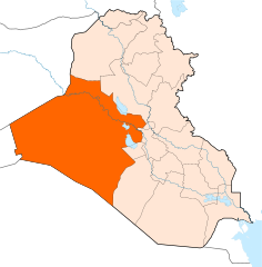
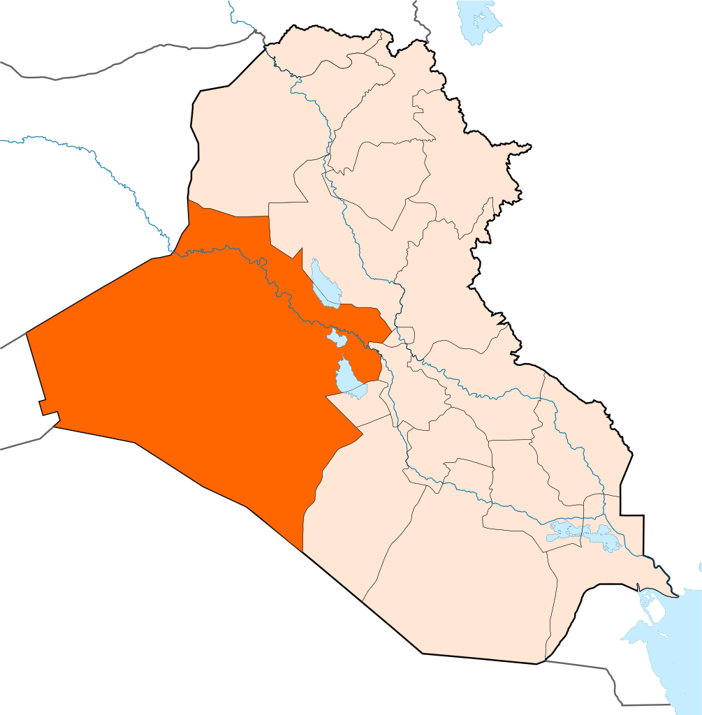
English: Map of Al-Anbar Province |
| Date | |
| Soorce |
Ain wirk This vector image includes elements that have been taken or adapted from this file: |
| Author | Rafy |
Licensin
I, the copyright holder of this work, hereby publish it under the following licenses:

|
Permission is grantit tae copy, distribute an/or modify this document unner the terms o the GNU Free Documentation License, Version 1.2 or ony later version published bi the Free Software Foundation; wi no Invariant Sections, no Front-Cover Texts, an no Back-Cover Texts. A copy o the license is includit in the section enteetled GNU Free Documentation License. |
This file is licensed unner the Creative Commons Attribution-Share Alike 3.0 Unported license.
- Ye are free:
- tae share – tae copy, distribute an transmit the wirk
- tae remix – tae adapt the wirk
- Unner the follaein condeetions:
- attribution – Ye must attribute the wirk in the manner specified bi the author or licensor (but nae in ony way that suggests that thay endorse ye or yer uise o the wirk).
- share alik – If ye alter, transform, or big upon this wirk, ye mey distribute the resultin wirk anly unner the same or seemilar license tae this ane.
Ye mey select the license o yer choice.
File history
Clap oan ae date/time fer tae see the file aes it kithed at that time.
| Date/Time | Thummnail | Dimensions | Uiser | Comment | |
|---|---|---|---|---|---|
| current | 14:30, 17 Juin 2014 | | 1,241 × 1,264 (304 KB) | Kathovo | Reverted to version as of 12:22, 27 January 2011 |
| 01:59, 13 Juin 2014 |  | 1,241 × 1,264 (316 KB) | Spesh531 | with black outline | |
| 01:50, 13 Juin 2014 |  | 1,241 × 1,264 (316 KB) | Spesh531 | with halabja | |
| 12:22, 27 Januar 2011 |  | 1,241 × 1,264 (304 KB) | Kathovo | {{Information |Description ={{en|1=Al-Anbar map}} |Source ={{own}} |Author =Rafy |Date = |Permission = |other_versions = }} Category:Al Anbar Province |
Eimage airtins
The follaein pages airts tae this image:
Global file uisage
The follaein ither wikis uise this file:
- Uisage on ar.wikipedia.org
- محافظة الأنبار
- الفلوجة
- الرمادي
- راوة
- عانة (العراق)
- هيت
- الحبانية
- النخيب
- الخالدية (الأنبار)
- قالب:مدن الأنبار
- الرطبة
- الحقلانية
- الرحالية
- حديثة (الأنبار)
- كبيسة
- الكرمة (العراق)
- بروانة
- الثرثار (مدينة)
- عكاشات
- طريبيل
- القعقاء
- ناحية الوليد
- البتراء (العراق)
- الأوسط
- الصقلاوية
- الرمانة (مدينة)
- المعمورة (القائم)
- الكرابلة (مدينة)
- العبيدي (مدينة)
- جبة (العراق)
- حصيبة الشرقية
- عامرية الفلوجة
- السجر
- الساجرية
- الهبارية (العراق)
- الكسرة (الأنبار)
- الفرات (ناحية)
- المحمدي (ناحية)
- الريحانة (العراق)
- الحميرية (ناحية)
- النهيدين
- الجزيرة (ناحية)
- قضاء العامرية
- آلوس
- الصوفية (ناحية)
- الشهابي (الأنبار)
- سكنية الثرثار
- القائم (مدينة)
- قالب:مدن محافظة الأنبار
- حرب العراق بمحافظة الأنبار
View mair global usage o this file.