
File:Aberdeen UK location map.svg

Size of this PNG preview of this SVG file: 719 × 600 pixels. Ither resolutions: 288 × 240 pixels | 575 × 480 pixels | 921 × 768 pixels | 1,227 × 1,024 pixels | 2,455 × 2,048 pixels | 1,425 × 1,189 pixels.
Oreeginal file (SVG file, nominallie 1,425 × 1,189 pixels, file size: 630 KB)
| Descreeption |
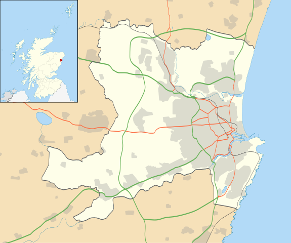
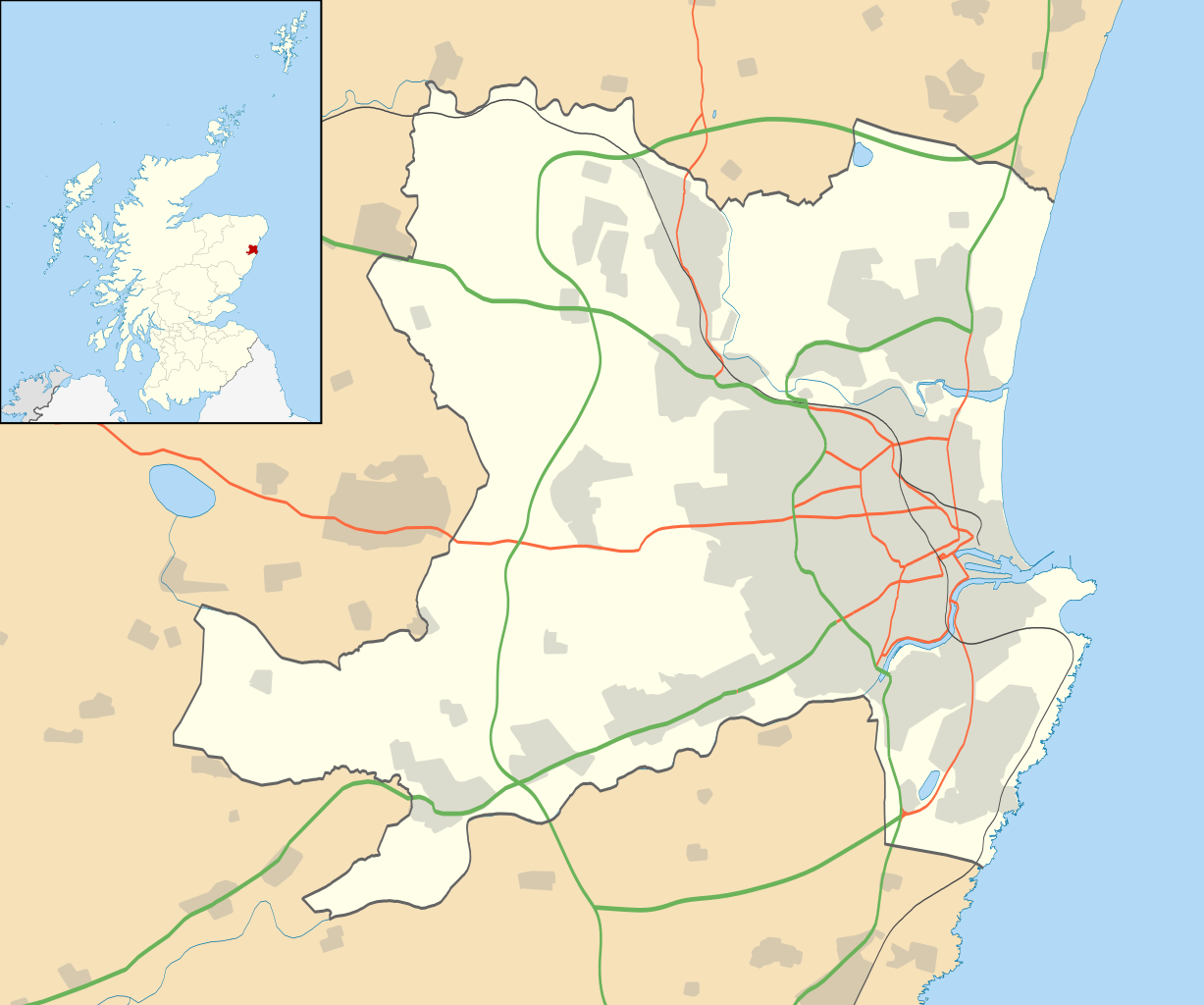
Blank map of Aberdeen, UK with the following information shown:
Equirectangular map projection on WGS 84 datum, with N/S stretched 180% Geographic limits:
|
| Date | |
| Soorce |
|
| Author | Nilfanion, created using Ordnance Survey data |
| Permission (Reuisin this file) |
This file is licensed unner the Creative Commons Attribution-Share Alike 3.0 Unported license. Attribution: Contains Ordnance Survey data © Crown copyright and database right
|
| Other versions | File:Aberdeen UK blank map.svg - Blank map |
File history
Clap oan ae date/time fer tae see the file aes it kithed at that time.
| Date/Time | Thummnail | Dimensions | Uiser | Comment | |
|---|---|---|---|---|---|
| current | 17:19, 1 Julie 2020 | | 1,425 × 1,189 (630 KB) | NordNordWest | + Aberdeen Western Peripheral Route |
| 19:55, 26 September 2010 |  | 1,425 × 1,189 (821 KB) | Nilfanion | {{Information |Description=Blank map of Aberdeen, UK with the following information shown: *Administrative borders *Coastline, lakes and rivers *Roads and railways *Urban areas Equirectangular map projection on WGS 84 datum, with N/S stret |
Eimage airtins
The follaein pages airts tae this image:
Global file uisage
The follaein ither wikis uise this file:
- Uisage on ar.wikipedia.org
- Uisage on azb.wikipedia.org
- Uisage on ba.wikipedia.org
- Uisage on bg.wikipedia.org
- Uisage on ceb.wikipedia.org
- Uisage on de.wikipedia.org
- Uisage on en.wikipedia.org
- Aberdeen
- Aberdeen Airport
- Cults, Aberdeen
- Westhill, Aberdeenshire
- Dyce
- Pittodrie Stadium
- Peterculter
- Old Aberdeen
- Mannofield
- Cruickshank Botanic Garden
- Portlethen
- Bieldside
- Milltimber
- Drumoak
- Bucksburn
- Template:Aberdeen-geo-stub
- Torry
- Kittybrewster
- Kincorth
- Bucks Burn
- Doonies Farm
- Cove Bay
- Tillydrone
- Foresterhill
- Footdee
- Aberdeen Royal Infirmary
- Royal Aberdeen Children's Hospital
- Aberdeen Maternity Hospital
- Royal Cornhill Hospital
- Woodend Hospital
- Woolmanhill Hospital
- Albyn Hospital
- Mastrick
- Aberdeen Art Gallery
- Tullos
- Danestone
- Bridge of Don
- Summerhill, Aberdeen
- Aberdeen Maritime Museum
- Kingswells
- Victoria Park, Aberdeen
View mair global usage o this file.