San Francisco de los Romo Municipality
San Francisco de los Romo | |
|---|---|
 Municipality location in Aguascalientes | |
| Coordinates: 22°05′N 102°16′W / 22.083°N 102.267°W | |
| Kintra | |
| State | Aguascalientes |
| Municipal seat | San Francisco de los Romo |
| Area | |
| • Municipality | 139.54 km2 (53.88 sq mi) |
| Population (2010) | |
| • Municipality | 35,769 |
| • Metro | 13,262 |
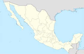
San Francisco de los Romo is a municipality in the Mexican state o Aguascalientes. It is locatit in the central pairt o the state.
The municipality, which haes an aurie o 139.54 km², reportit a 2010 Census population o 35,769. It is locatit in the middle of the Aguascalientes Valley, at 20 km towards north frae the state caipital Aguascalientes; it adjoins wi the municipalities of Pabellón de Arteaga an Asientos tae the north, Jesús María tae the wast, an Aguascalientes tae the sooth-east.
The toun o San Francisco de los Romo, which is the saxt-lairgest commonty in the state, is locatit at the northwast corner o the municipality an serves as its municipal seat.
References[eedit | eedit soorce]
- Link to tables of population data from Census of 2005 Instituto Nacional de Estadística, Geografía e Informática (INEGI)
- Aguascalientes Archived 2007-05-15 at the Wayback Machine Enciclopedia de los Municipios de México
Freemit airtins[eedit | eedit soorce]
- Ayuntamiento de San Francisco de los Romo Offeecial wabsteid
- Gobierno del Estado de Aguascalientes Offeecial wabsteid o State o Aguascalientes


