
Khan Yunis
Khan Yunis | |
|---|---|
| Ither transcription(s) | |
| • Arabic | خان يونس |
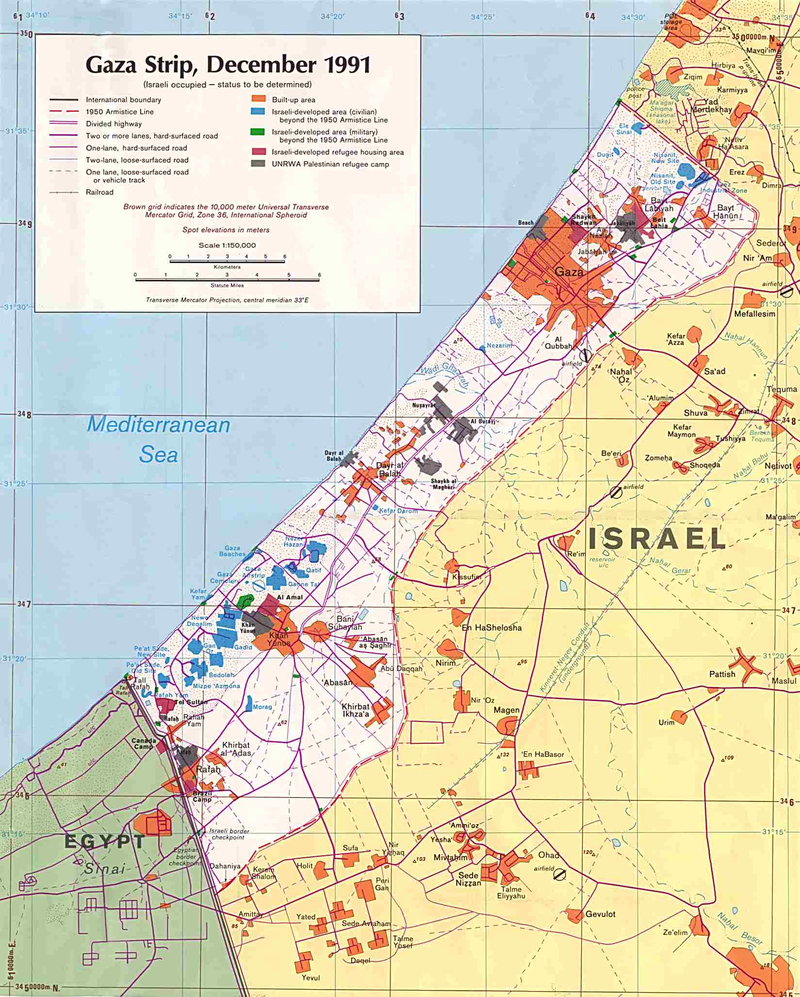
 Location o Khan Yunis in the Gaza Strip | |
 Khan Yunis Location o Khan Yunis within the Palestinian territories | |
| Coordinates: 31°20′40″N 34°18′11″E / 31.34444°N 34.30306°ECoordinates: 31°20′40″N 34°18′11″E / 31.34444°N 34.30306°E | |
| Govrenorate | Khan Yunis |
| Foondit | 1917 |
| Govrenment | |
| • Teep | Ceety |
| • Heid o Municipality | Muhammad Jawad Abd Al-Khaliq Al-Farra |
| Area | |
| • Jurisdiction | 54.56 km2 (21.07 sq mi) |
| Population (2007) | |
| • Jurisdiction | 142,637[1] |
| Name meanin | "Jonah's Inn" |
| Website | www.khanyounis.mun.ps |
Khan Yunis - aften spelt Khan Younis or Khan Yunnis - (Arabic: خان يونس; literally Jonah's Caravanserai) is a ceety an adjacent refugee camp in the soothren pairt o the Gaza Strip. Accordin tae the Palestinian Central Bureau o Statistics the ceety, its refugee camp, an its immediate surroondins haed a total population o 180,000 in 2006.[2] Although Khan Yunis lees anerlie 4 kilometers frae the Mediterranean Sea the climate o Khan Yunis is semi-arid wi temperatur reachin heich tae 30 degree C in simmer an decreasin heich at 10 degree C in winter region wi an annual rainfaw o approximately 260 mm.
Internaitional relations[eedit | eedit soorce]
Twin touns — Sister ceeties[eedit | eedit soorce]
Khan Yunis is twinned wi the follaein ceeties:
See an aw[eedit | eedit soorce]
References[eedit | eedit soorce]
- ↑ 2007 PCBS Census. Palestinian Central Bureau of Statistics (PCBS). 2009. p. 63.
- ↑ Projected Mid -Year Population Archived 2012-02-07 at the Wayback Machine for Khan Yunis Governorate by Locality 2004- 2006
Freemit airtins[eedit | eedit soorce]
- Khan Younis, articles from UNWRA
- close-up map of Gaza