
Juchitán Destrict
Juchitán Destrict | |
|---|---|
Destrict | |
 Oaxaca regions an destricts: Istmo tae the east | |
| Coordinates: 16°26′N 95°01′W / 16.433°N 95.017°W | |
| Kintra | |
| State | Oaxaca |
Juchitán Destrict is locatit in the east o the Istmo de Tehuantepec region o the State o Oaxaca, Mexico, coverin the soohren pairt o a law lyin corridor throu the muntains that separates the Guwf o Mexico frae the Paceefic Ocean. The destrict haes a aurie o 13,300 km2 an a population as o 2005 o 339,445.
Environs[eedit | eedit soorce]
The climate is wairm. The destrict is relatively flat in the soothren coastal plain, boondit bi lagoons an then the ocean. Inland tae the north it is hillier, risin tae the crest o the isthmus an then descendin towards the Veracruz coastal plain o the Guwf o Mexico. The laund rises tae muntains tae the Wast (Sierra Madre de Oaxaca) an the East (Sierra Madre de Chiapas).[1] The municipalities o Santa María Chimalapa an San Miguel Chimalapa contain a lairge pairt o the Selva Zoque, the lairgest tract o tropical rainforest in Mexico, which contains the majority o terrestrial biodiversity in the kintra.[2]
Economy[eedit | eedit soorce]
Ither than in the touns o the trans-isthmus corridor in the wast o the destrict, maist fowk are engagit in agricultur. Near the coast, there is fishin activity, an in some inland auries fine lumber is extractit for uise in furnitur makkin.[1] The govrenment haes plans tae develop the trans-isthmus corridor. This includes impruivin transportation routes athort the isthmus atween the Caribbean an the Paceefic, an developin a industrial zone alang the heich-gate. Ither plans include creatin coffee plantations an cattle corridors, expandin production o beans, maize an chili an exploitin the bio-genetic resources o native medicinal plants.[3]

The isthmus haes reliable, dominant north-sooth winds. Some pilot wind ferms hae been built, notably at La Venta.[4] Thare are plans tae build mair, awtho thare haes been local resistance due tae the communal awnership o laund and concerns that the annual rental prices affered are too law[5][6] A plan first proponit in 1977 for a dam in the Chimalapas haes been stawed due tae environmental concerns.[3] In Juin 2008 the State o Oaxaca wis again proponin construction o a storage dam in the Rio El Corte Basin in the Chimalapa sub-region, wi the potential tae irrigate 100,000 hectares o the Isthmus o Tehuantepec an tae supplee watter tae the Salina Cruz Refinery.[7]
Municipalities[eedit | eedit soorce]

The destrict includes the follaein municipalities:[1]
| Municipality | Aurie km2 | 2005 Population |
Indigenous Population |
|---|---|---|---|
| Asunción Ixtaltepec | 547 | 14,438 | 6,583 |
| Chahuites | 161 | 9,929 | |
| Ciudad Ixtepec | 230 | 24,181 | 4,667 |
| El Barrio de La Soledad | 233 | 13,439 | |
| El Espinal | 83 | 8,219 | |
| Juchitán de Zaragoza | 415 | 85,869 | |
| Matías Romero | 1,460 | 38,421 | |
| Reforma de Pineda | 194 | 2,691 | |
| San Dionisio del Mar | 237 | 5,165 | 2,639 |
| San Francisco del Mar | 401 | 6,874 | 926 |
| San Francisco Ixhuatán | 407 | 9,050 | |
| San Juan Guichicovi | 564 | 27,646 | 19,367 |
| San Miguel Chimalapa | 1,593 | 6,541 | 1,988 |
| San Pedro Tapanatepec | 545 | 13,647 | 609 |
| Santa María Chimalapa | 3,572 | 8,643 | 3,381 |
| Santa María Petapa | 145 | 13,867 | 3,294 |
| Santa María Xadani | 89 | 7,283 | 6,114 |
| Santiago Niltepec | 680 | 4,961 | 56 |
| Santo Domingo Ingenio | 355 | 7,299 | 465 |
| Santo Domingo Petapa | 232 | 7,583 | 2,696 |
| Santo Domingo Zanatepec | 1,024 | 10,716 | 211 |
| Unión Hidalgo | 133 | 12,983 | 7,230 |
Gallery[eedit | eedit soorce]
-
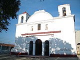 Kirk o the Virgin o Asunción
 -
 Municipal Palace o Asunción
 -
 Kiosk in the Jesus Rasgado pairk, o Asunción
 -
 Kirk in Espinal
 -
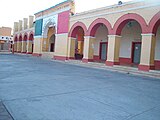
 Palacio Municipal in Ciudad Ixtepec
 -
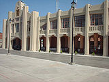
 Juchitán Municipal Palace
 -
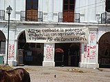 Graffiti in Juchitán
 -
 Railwey Station, the landmark o Matias Romero
 -
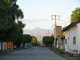 Street in Santo Domingo Zanatepec


References[eedit | eedit soorce]
- ↑ a b c "Enciclopedia de los Municipios de México: Estado de Oaxaca". Archived frae the original on 10 Januar 2013. Retrieved 8 Julie 2010.
- ↑ "Selva Zoque" (PDF). Gulf Coast Bird Observatory. Retrieved 28 Juin 2010.[deid airtin]
- ↑ a b Emanuel Gómez (marzo 2002). "El futuro de la Selva Zoque". La Jornada, Suplemento Ojarasca Nº 59, (in Spanish). Retrieved 2010-06-27. Check date values in:
|date=(help)CS1 maint: extra punctuation (link) CS1 maint: unrecognised leid (link) - ↑ "3er. Cologuio Internacional Sobre Oportunidades para el Desarrollo de la Ventosa, Oaxaca, Mexico" (PDF). Comisión Nacional para el Uso Eficiente de la Energía. Archived frae the original (PDF) on 21 August 2010. Retrieved 16 Julie 2010.
- ↑ Karen Trejo (14 August 2008). "Wind parks take over indigenous lands". Latinamerica Press. Archived frae the original on 7 Januar 2011. Retrieved 15 Julie 2010.
- ↑ "Wind farms in Mexico to generate green power for Cemex cement company and the Wal-Mart retail chain". Elsevier Ltd. 11 Januar 2010. Retrieved 15 Julie 2010.
- ↑ "Respuestas de las solicitudes de información recibidas el día 25 de de 2008: Folio: UE/LX/0670/2008". SENADO DE LA REPÚBLICA DE MEXICO. Archived frae the original on 22 Julie 2011. Retrieved 26 Juin 2010.