
File:Western Asia (orthographic projection).svg

Size of this PNG preview of this SVG file: 600 × 600 pixels. Ither resolutions: 240 × 240 pixels | 480 × 480 pixels | 768 × 768 pixels | 1,024 × 1,024 pixels | 2,048 × 2,048 pixels | 683 × 683 pixels.
Oreeginal file (SVG file, nominallie 683 × 683 pixels, file size: 929 KB)
.svg)
بيلسان
Ootline
| Descreeption |
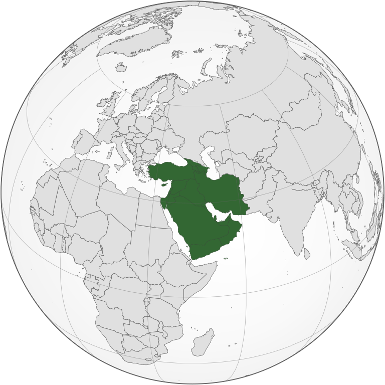
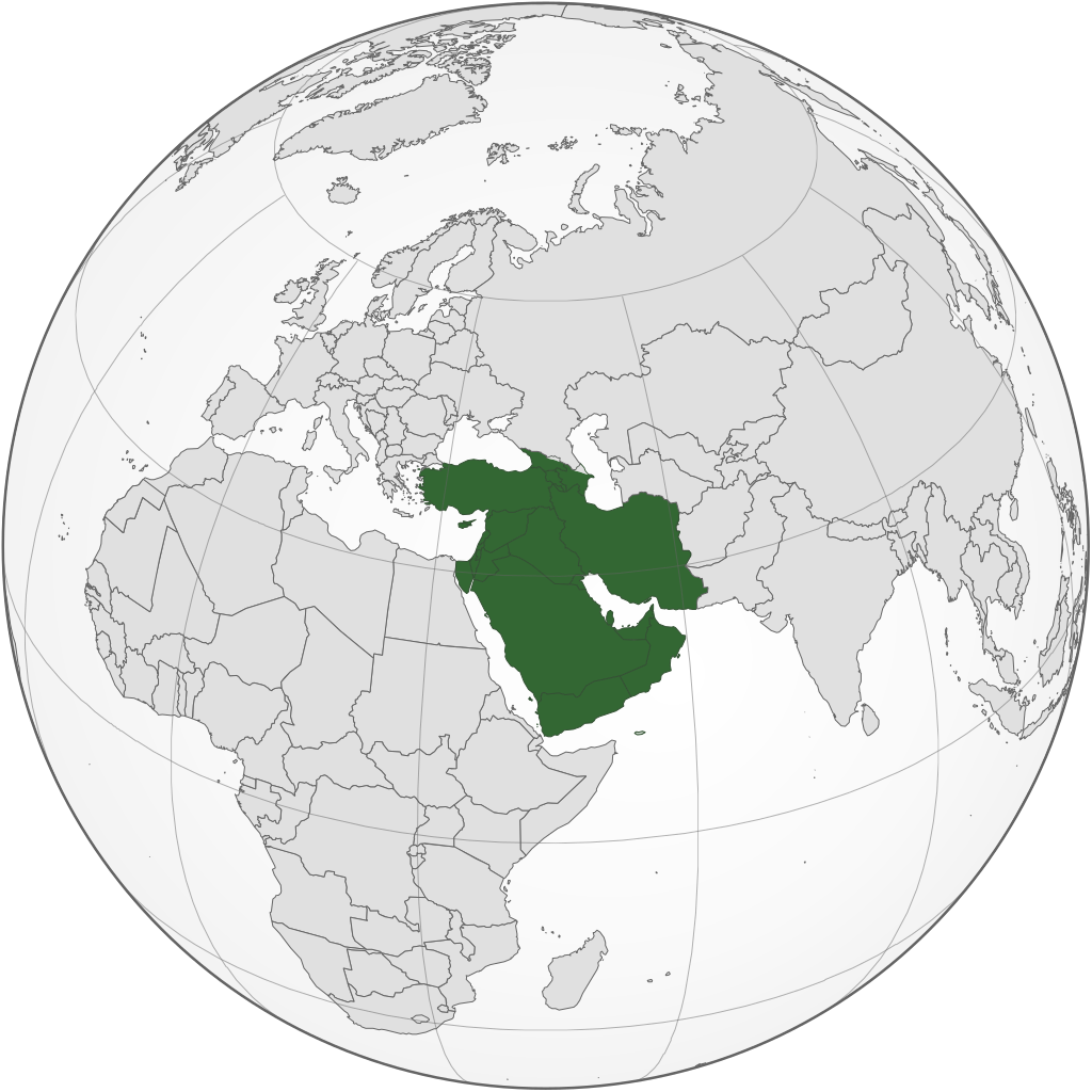
English: West Asia (orthographic projection) |
| Soorce | Ain wirk |
| Author | Keepscases |
| SVG genesis | This locator map was created with Inkscape. |
Licensin
I, the copyright holder of this work, hereby publish it under the following licenses:
This file is licensed unner the Creative Commons Attribution-Share Alike 3.0 Unported license.
- Ye are free:
- tae share – tae copy, distribute an transmit the wirk
- tae remix – tae adapt the wirk
- Unner the follaein condeetions:
- attribution – Ye must attribute the wirk in the manner specified bi the author or licensor (but nae in ony way that suggests that thay endorse ye or yer uise o the wirk).
- share alik – If ye alter, transform, or big upon this wirk, ye mey distribute the resultin wirk anly unner the same or seemilar license tae this ane.

|
Permission is grantit tae copy, distribute an/or modify this document unner the terms o the GNU Free Documentation License, Version 1.2 or ony later version published bi the Free Software Foundation; wi no Invariant Sections, no Front-Cover Texts, an no Back-Cover Texts. A copy o the license is includit in the section enteetled GNU Free Documentation License. |
Ye mey select the license o yer choice.
File history
Clap oan ae date/time fer tae see the file aes it kithed at that time.
.svg&dir=prev)
.svg&offset=20170511142803)
.svg&offset=&limit=20)
.svg&offset=&limit=50)
.svg&offset=&limit=100)
.svg&offset=&limit=250)
.svg&offset=&limit=500)
| Date/Time | Thummnail | Dimensions | Uiser | Comment | |
|---|---|---|---|---|---|
| current | 08:33, 5 September 2022 | | 683 × 683 (929 KB) | Рагин1987 | Final edit |
| 12:01, 4 September 2022 |  | 683 × 683 (927 KB) | Рагин1987 | Correction | |
| 18:50, 31 August 2022 |  | 2,048 × 2,048 (1.05 MB) | Рагин1987 | Small correction | |
| 15:11, 31 August 2022 |  | 2,048 × 2,048 (1.05 MB) | Рагин1987 | Small correction (Socotra Island is geologically closer to Africa) | |
| 18:45, 30 August 2022 |  | 2,048 × 2,048 (1.05 MB) | Рагин1987 | More correct visualization of the dividing line on the territory of the Caucasus Range | |
| 14:21, 16 November 2019 |  | 683 × 683 (919 KB) | Afrogindahood | Fixed some border errors | |
| 13:05, 16 November 2019 |  | 512 × 512 (502 KB) | Afrogindahood | Fixed the gradient background not shown in the previous version | |
| 03:18, 31 October 2019 |  | 737 × 737 (834 KB) | Afrogindahood | Added Gaza Strip, Sinai Peninsula which is still part of Asia and removed Eastern Thrace which is part of Southeastern Europe | |
| 18:09, 11 Mey 2017 |  | 553 × 553 (332 KB) | LouisAragon | Rv disruption. 1 contradicted subdepartment means absolutely nothing. | |
| 14:28, 11 Mey 2017 |  | 590 × 590 (410 KB) | Jcfidy | Quito Irán [http://data.un.org/CountryProfile.aspx?crName=Iran%20%28Islamic%20Republic%20of%29 referencia] |
Eimage airtins
The follaein pages airts tae this image:
Global file uisage
The follaein ither wikis uise this file:
- Uisage on ab.wikipedia.org
- Uisage on af.wikipedia.org
- Uisage on ar.wikipedia.org
- Uisage on ast.wikipedia.org
- Uisage on av.wikipedia.org
- Uisage on azb.wikipedia.org
- Uisage on ba.wikipedia.org
- Uisage on be.wikipedia.org
- Uisage on bg.wikipedia.org
- Uisage on bn.wikipedia.org
- Uisage on br.wikipedia.org
- Uisage on bs.wikipedia.org
- Uisage on bxr.wikipedia.org
- Uisage on ca.wikipedia.org
- Uisage on cdo.wikipedia.org
- Uisage on cs.wikipedia.org
- Uisage on cv.wikipedia.org
- Uisage on cy.wikipedia.org
- Uisage on da.wikipedia.org
- Uisage on de.wikipedia.org
- Uisage on de.wiktionary.org
- Uisage on diq.wikipedia.org
- Uisage on el.wikipedia.org
- Uisage on en.wikipedia.org
- List of conflicts in the Near East
- Asian cuisine
- West Asia
- Template talk:Countries of Asia
- Wikipedia:Userboxes/Location/Asia
- Wikipedia:WikiProject Western Asia
- User:Buaidh/Test4
- Category:Fauna of West Asia
- Category:West Asian countries
- Talk:Arab Spring/Archive 8
- Category:Geography of West Asia
- Category:Wikipedians interested in West Asia
- Category:Biota of West Asia
- List of Asian cuisines
- User:FARHAAD 1992
- User:Ziraro
View mair global usage o this file.
.svg)
.svg)