
File:Wales Bridgend locator map.svg

Size of this PNG preview of this SVG file: 502 × 600 pixels. Ither resolutions: 201 × 240 pixels | 402 × 480 pixels | 643 × 768 pixels | 857 × 1,024 pixels | 1,714 × 2,048 pixels | 1,047 × 1,251 pixels.
Oreeginal file (SVG file, nominallie 1,047 × 1,251 pixels, file size: 146 KB)
Ootline
| Descreeption |
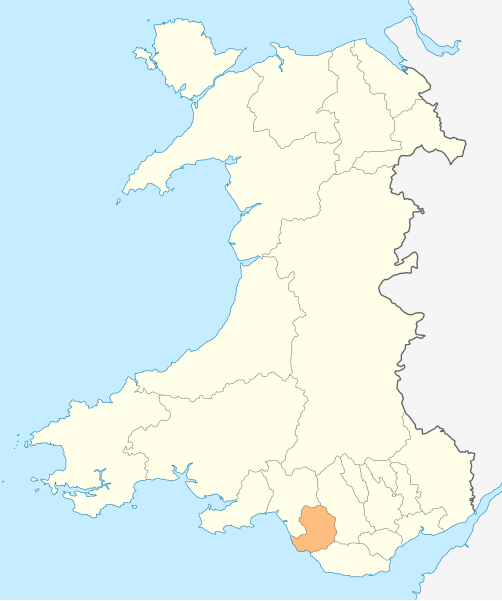
Deutsch: Lagekarte von Bridgend in Wales
English: Locator map of Bridgend in Wales |
| Date | |
| Soorce | Ain wirk |
| Author | NordNordWest |
| Permission (Reuisin this file) |
I, the copyright holder of this work, hereby publish it under the following license: This file is licensed unner the Creative Commons Attribution-Share Alike 3.0 Unported license.
|

|
This map has been made or improved in the German Kartenwerkstatt (Map Lab). You can propose maps to improve as well.
|
File history
Clap oan ae date/time fer tae see the file aes it kithed at that time.
| Date/Time | Thummnail | Dimensions | Uiser | Comment | |
|---|---|---|---|---|---|
| current | 18:47, 4 Mey 2010 | | 1,047 × 1,251 (146 KB) | NordNordWest | {{int:filedesc}} {{Information |Description= {{de|Lagekarte von Bridgend in Wales}} {{en|Locator map of Bridgend in Wales}} |Source={{Own}} |Date=2010-05-04 |Author={{U|NordNordWest}} |Permission={{self|cc-by-sa-3.0}} |other_versions= }} {{Kartenwerkstat |
Eimage airtins
The follaein pages airts tae this image:
Global file uisage
The follaein ither wikis uise this file:
- Uisage on en.wikipedia.org
- Ewenny Priory
- Bridgend
- Porthcawl
- Maesteg
- Bridgend County Borough
- Pencoed
- Kenfig
- Ogwr
- Ogmore Castle
- Llangynwyd
- Tondu
- Merthyr Mawr
- Brackla
- Candleston Castle
- Nottage
- List of places in Bridgend County Borough
- Heol-y-Cyw
- Pyle
- Aberkenfig
- Coity Castle
- Pontycymer
- Blaengarw
- Coychurch
- Bridgend Industrial Estate
- Template:Bridgend-geo-stub
- Newton, Porthcawl
- Cefn Glas
- Tir Iarll
- Bridgend County Borough Council
- Sarn, Bridgend
- Ogmore Vale
- Bettws, Bridgend
- Bryncethin
- Pen-y-fai, Bridgend
- Ewenny River
- Llampha
- Cornelly
- Nant-y-moel
- Cwmfelin
- North Cornelly
- Caerau, Bridgend
- Llangeinor
- Brynmenyn
- Template:Bridgend
- Kenfig Castle
- South Cornelly
- Cefn Cribwr
- Garw Valley
- Newcastle Castle, Bridgend
- Blackmill
View mair global usage o this file.