
File:Sumbawa Topography.png
Size o this luikower: 787 × 600 pixels. Ither resolutions: 315 × 240 pixels | 630 × 480 pixels | 1,008 × 768 pixels | 1,280 × 976 pixels | 2,440 × 1,860 pixels.
Oreeginal file (2,440 × 1,860 pixels, file size: 1.91 MB, MIME type: image/png)
Ootline
| Descreeption |
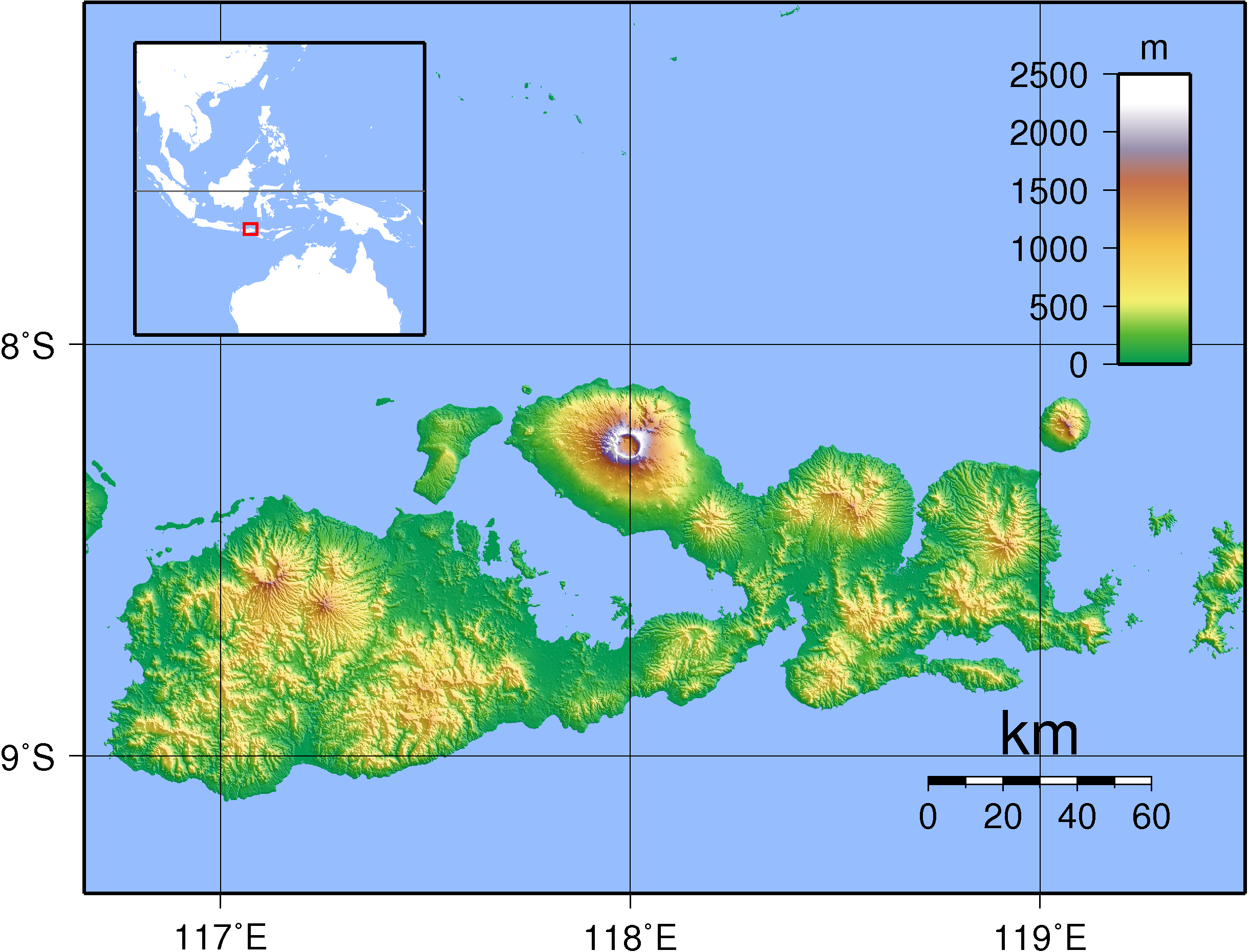
English: Topographic map of Sumbawa, Indonesia. Created with GMT from SRTM data.
Русский: Топографическая карта острова Сумбава; кальдера вулкана Тамбора расположена на северном полуострове. |
| Date | |
| Soorce | Ain wirk |
| Author | Sadalmelik |
Licensin
I, the copyright holder of this work, hereby publish it under the following licenses:

|
Permission is grantit tae copy, distribute an/or modify this document unner the terms o the GNU Free Documentation License, Version 1.2 or ony later version published bi the Free Software Foundation; wi no Invariant Sections, no Front-Cover Texts, an no Back-Cover Texts. A copy o the license is includit in the section enteetled GNU Free Documentation License. |
This file is licensed under the Creative Commons Attribution-Share Alike 3.0 Unported, 2.5 Generic, 2.0 Generic and 1.0 Generic license.
- Ye are free:
- tae share – tae copy, distribute an transmit the wirk
- tae remix – tae adapt the wirk
- Unner the follaein condeetions:
- attribution – Ye must attribute the wirk in the manner specified bi the author or licensor (but nae in ony way that suggests that thay endorse ye or yer uise o the wirk).
- share alik – If ye alter, transform, or big upon this wirk, ye mey distribute the resultin wirk anly unner the same or seemilar license tae this ane.
Ye mey select the license o yer choice.
File history
Clap oan ae date/time fer tae see the file aes it kithed at that time.
| Date/Time | Thummnail | Dimensions | Uiser | Comment | |
|---|---|---|---|---|---|
| current | 20:38, 11 September 2007 | | 2,440 × 1,860 (1.91 MB) | Sadalmelik | {{Information |Description=Topographic map of Sumbawa, Indonesia. Created with GMT from SRTM data. |Source=self-made |Date=Sep 11, 2007 |Author= Sadalmelik }} Category:Maps of Indonesia Category:Topographic maps of Asia |
Eimage airtins
The'r nae pages airts tae this eimage.
Global file uisage
The follaein ither wikis uise this file:
- Uisage on af.wikipedia.org
- Uisage on ar.wikipedia.org
- Uisage on ast.wikipedia.org
- Uisage on az.wikipedia.org
- Uisage on ban.wikipedia.org
- Uisage on be.wikipedia.org
- Uisage on bg.wikipedia.org
- Uisage on bn.wikipedia.org
- Uisage on ca.wikipedia.org
- Uisage on ceb.wikipedia.org
- Uisage on cs.wikipedia.org
- Uisage on cy.wikipedia.org
- Uisage on da.wikipedia.org
- Uisage on de.wikipedia.org
- Uisage on el.wikipedia.org
- Uisage on en.wikipedia.org
- Sumbawa
- Sultan Muhammad Salahudin Airport
- Portal:Volcanoes/Selected article
- Sape Strait
- Portal:Volcanoes/Selected article/11
- Batu Hijau mine
- Alas Strait
- Saleh Bay
- 1815 eruption of Mount Tambora
- Moyo River
- Brang Biji River
- List of rivers of Sumbawa
- Module:Location map/data/Indonesia Sumbawa
- Module:Location map/data/Indonesia Sumbawa/doc
- User:Ty654/List of earthquakes from 1900-1949 exceeding magnitude 7+
- User:Ty654/List of earthquakes from 1950-1954 exceeding magnitude 6+
- User:Ty654/List of earthquakes from 2000-2004 exceeding magnitude 6+
- User:Ty654/List of earthquakes from 2005-2009 exceeding magnitude 6+
- User:Ty654/List of earthquakes from 2015-2019 exceeding magnitude 6+
- Oi Panihi
- Kawinda Toi
- Uisage on eo.wikipedia.org
View mair global usage o this file.