
File:Saare municipalities 1999–2014.png

Size o this luikower: 594 × 600 pixels. Ither resolutions: 238 × 240 pixels | 476 × 480 pixels | 972 × 981 pixels.
Oreeginal file (972 × 981 pixels, file size: 78 KB, MIME type: image/png)
Ootline
| Descreeption |
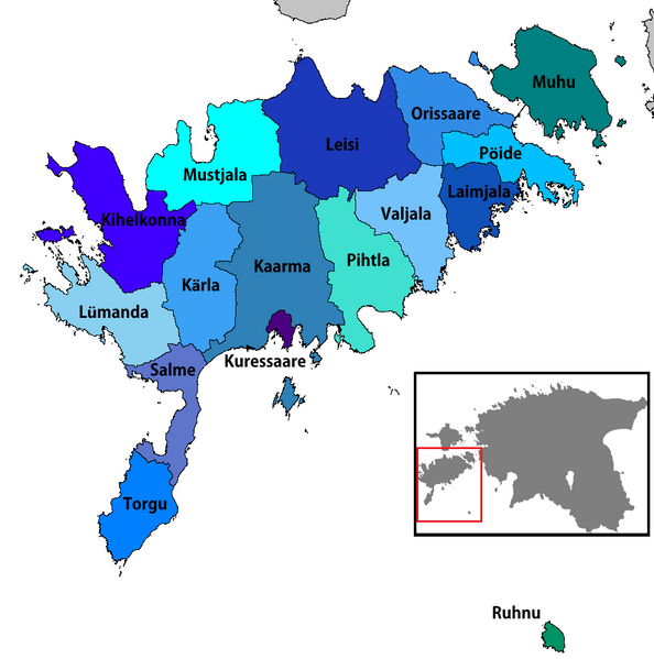
English: Map of the municipalities of Saare county in Estonia, 1999–2014
Eesti: Saare maakonna omavalitsused (1999–2014) |
| Date | |
| Soorce | Ain wirk |
| Author | Rarelibra |
| Other versions |
|


Licensin
| I, the copyright holder of this work, release this work into the public domain. This applies worldwide. In some countries this may not be legally possible; if so: I grant anyone the right to use this work for any purpose, without any conditions, unless such conditions are required by law. |
File history
Clap oan ae date/time fer tae see the file aes it kithed at that time.
| Date/Time | Thummnail | Dimensions | Uiser | Comment | |
|---|---|---|---|---|---|
| current | 18:09, 25 Januar 2019 | | 972 × 981 (78 KB) | Risto est | Conformity with other similar images |
| 20:58, 24 November 2017 |  | 702 × 481 (162 KB) | NordNordWest | Reverted to version as of 12:35, 3 May 2013 (UTC); back to cropped version | |
| 14:15, 9 November 2017 |  | 1,056 × 816 (38 KB) | RoMex | Reverted to version as of 19:30, 8 January 2007 (UTC), This map now illustrates historic municipal divisions prior to the 2017 reform. | |
| 14:38, 17 December 2014 |  | 957 × 655 (49 KB) | Pikne | update | |
| 12:35, 3 Mey 2013 |  | 702 × 481 (162 KB) | P. S. Burton | ||
| 19:30, 8 Januar 2007 |  | 1,056 × 816 (38 KB) | Rarelibra | Updated map due to 2006 changes. | |
| 17:35, 22 December 2006 |  | 1,056 × 816 (39 KB) | Rarelibra | Map of the municipalities of Saare county in Estonia. Created by ~~~~ for public domain use, using MapInfo Professional v8.5 and various mapping resources. |
Eimage airtins
The follaein pages airts tae this image:
Global file uisage
The follaein ither wikis uise this file:
- Uisage on ar.wikipedia.org
- Uisage on ba.wikipedia.org
- Uisage on cs.wikipedia.org
- Uisage on de.wikipedia.org
- Uisage on en.wikipedia.org
- Uisage on es.wikipedia.org
- Uisage on et.wikipedia.org
- Uisage on fi.wikipedia.org
- Uisage on fr.wikipedia.org
- Uisage on he.wikipedia.org
- Uisage on ka.wikipedia.org
- Uisage on lt.wikipedia.org
- Uisage on nl.wikipedia.org
- Uisage on nn.wikipedia.org
- Uisage on no.wikipedia.org
- Uisage on pt.wikipedia.org
- Uisage on ro.wikipedia.org
- Uisage on ru.wikipedia.org
- Uisage on sr.wikipedia.org
- Uisage on sv.wikipedia.org
- Uisage on uk.wikipedia.org