
File:Picardie region location map.svg

Size of this PNG preview of this SVG file: 794 × 600 pixels. Ither resolutions: 318 × 240 pixels | 636 × 480 pixels | 1,017 × 768 pixels | 1,280 × 967 pixels | 2,560 × 1,933 pixels | 1,842 × 1,391 pixels.
Oreeginal file (SVG file, nominallie 1,842 × 1,391 pixels, file size: 446 KB)
Ootline
| Camera location | | View this and other nearby images on: OpenStreetMap |
|---|
| Descreeption |
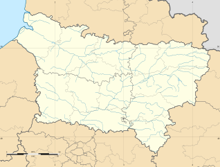
Français : Carte administrative vierge de la département de la Picardie, France, destinée à la géolocalisation.
|
| Date | |
| Soorce |
Ain wirk |
| Author | User:Bourrichon - fr:Bourrichon) |
| Other versions |
|

Licensin
I, the copyright holder of this work, hereby publish it under the following licenses:
This file is licensed unner the Creative Commons Attribution-Share Alike 3.0 Unported license.
- Ye are free:
- tae share – tae copy, distribute an transmit the wirk
- tae remix – tae adapt the wirk
- Unner the follaein condeetions:
- attribution – Ye must attribute the wirk in the manner specified bi the author or licensor (but nae in ony way that suggests that thay endorse ye or yer uise o the wirk).
- share alik – If ye alter, transform, or big upon this wirk, ye mey distribute the resultin wirk anly unner the same or seemilar license tae this ane.

|
Permission is grantit tae copy, distribute an/or modify this document unner the terms o the GNU Free Documentation License, Version 1.2 or ony later version published bi the Free Software Foundation; wi no Invariant Sections, no Front-Cover Texts, an no Back-Cover Texts. A copy o the license is includit in the section enteetled GNU Free Documentation License. |
Ye mey select the license o yer choice.
File history
Clap oan ae date/time fer tae see the file aes it kithed at that time.
| Date/Time | Thummnail | Dimensions | Uiser | Comment | |
|---|---|---|---|---|---|
| current | 15:51, 11 November 2012 | | 1,842 × 1,391 (446 KB) | Bourrichon | stretch |
| 13:50, 11 November 2012 |  | 1,842 × 1,242 (447 KB) | Bourrichon | == {{int:filedesc}} == {{Location|50|00|00|N|03|00|00|E|scale:3000000}} <br/> {{Information |Description={{fr|Carte administrative vierge de la département de la fr:Picardie (région), France, destinée ... |
Eimage airtins
The follaein pages airts tae this image:
Global file uisage
The follaein ither wikis uise this file:
- Uisage on ar.wikipedia.org
- Uisage on bg.wikipedia.org
- Uisage on ceb.wikipedia.org
- Uisage on de.wikipedia.org
- Uisage on el.wikipedia.org
- Uisage on en.wikipedia.org
- Uisage on eo.wikipedia.org
- Uisage on es.wikipedia.org
- Uisage on fa.wikipedia.org
- Uisage on fo.wikipedia.org
- Uisage on fr.wikipedia.org
- Parc Astérix
- Amiens Sporting Club
- Portail:Picardie
- Stade de la Licorne
- Sporting Club abbevillois Foot Côte picarde
- Hippodrome du Petit-Saint-Jean
- Liste des commanderies templières en Picardie
- Coliseum
- Utilisateur:Wrangel/brouillon
- Centre pénitentiaire de Château-Thierry
- Cité des bateliers
- Parc Saint-Paul
- Centre pénitentiaire de Liancourt
- Château de Boves
- Commanderie de Boncourt
- Projet:Cartographie/Cartes standards/France
- Viaduc de l'Avre
- Viaduc du Scardon
- Stade Pierre-Brisson
- Golf de Compiègne
- Golf de Morfontaine
- Golf de Chantilly
- Modèle:Géolocalisation/Picardie
- Modèle:Géolocdual/Picardie
View mair global usage o this file.