
File:Morocco location map.svg

Size of this PNG preview of this SVG file: 737 × 600 pixels. Ither resolutions: 295 × 240 pixels | 590 × 480 pixels | 944 × 768 pixels | 1,259 × 1,024 pixels | 2,517 × 2,048 pixels | 1,223 × 995 pixels.
Oreeginal file (SVG file, nominallie 1,223 × 995 pixels, file size: 278 KB)
Ootline
| Descreeption |
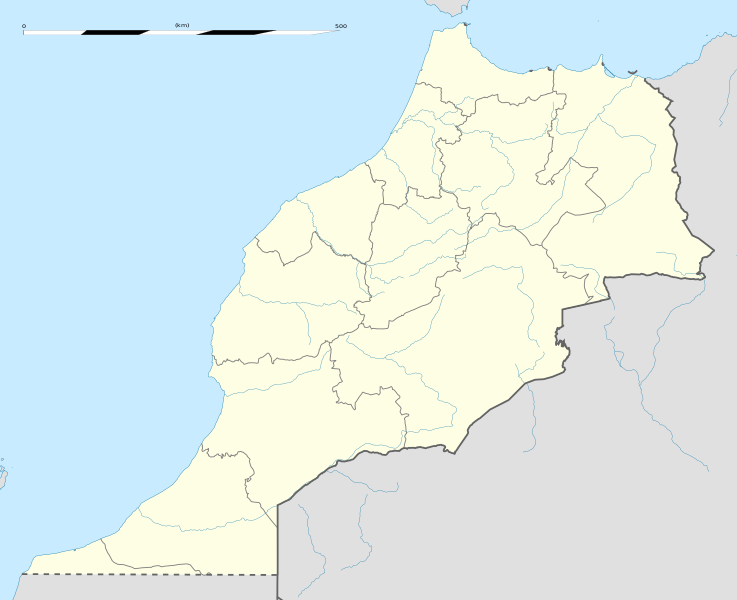
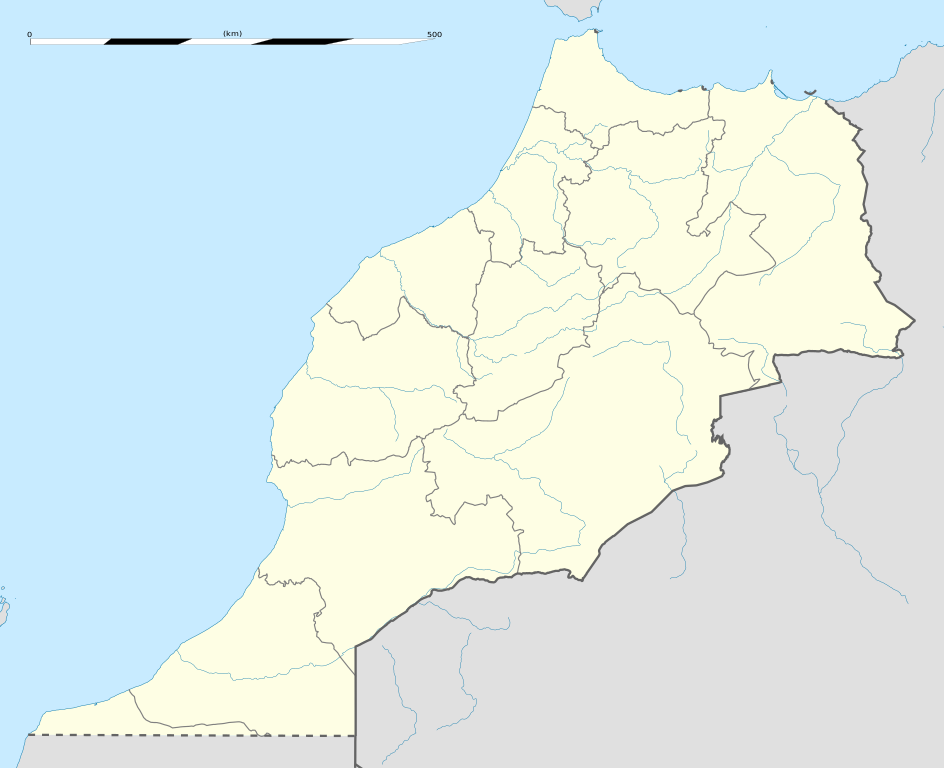
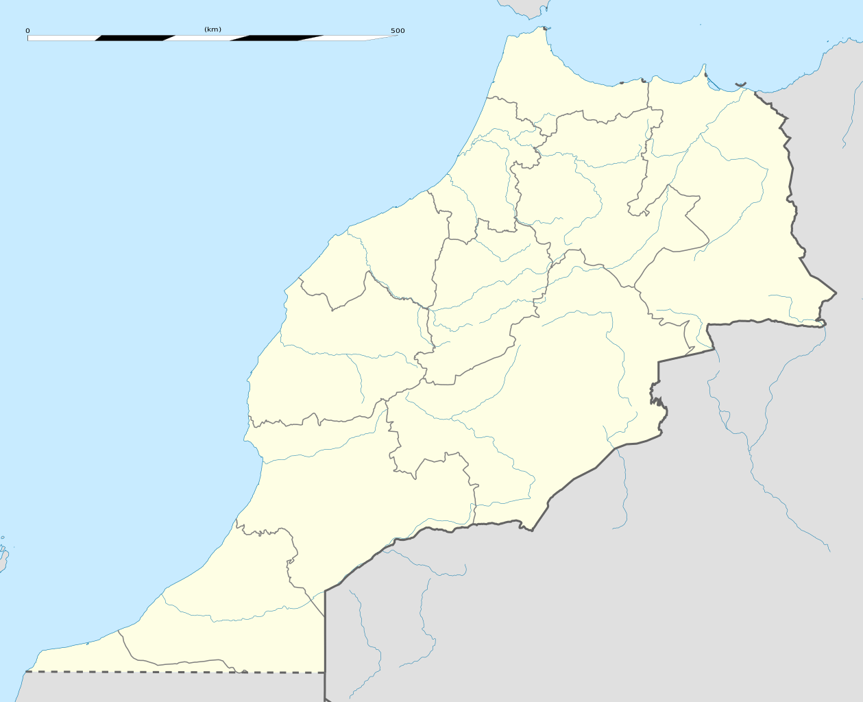
English: Blank administrative map of Morocco, for geo-location purposes.
Français : Carte administrative vierge du Maroc, destinée à la géolocalisation. Scale: 1:4,000,000 (precision: 1,000 m)
Geographic limits of the map:
|
||
| Date | |||
| Soorce |
Ain wirk
|
||
| Author | Eric Gaba (Sting - fr:Sting) | ||
| Permission (Reuisin this file) |
|
||
| Other versions |
Derivative works of this file: Marruecos1909.PNG
|

| Camera location | | View this and other nearby images on: OpenStreetMap |
|---|
Licensin
I, the copyright holder of this work, hereby publish it under the following licenses:
This file is licensed unner the Creative Commons Attribution-Share Alike 3.0 Unported license.
- Ye are free:
- tae share – tae copy, distribute an transmit the wirk
- tae remix – tae adapt the wirk
- Unner the follaein condeetions:
- attribution – Ye must attribute the wirk in the manner specified bi the author or licensor (but nae in ony way that suggests that thay endorse ye or yer uise o the wirk).
- share alik – If ye alter, transform, or big upon this wirk, ye mey distribute the resultin wirk anly unner the same or seemilar license tae this ane.

|
Permission is grantit tae copy, distribute an/or modify this document unner the terms o the GNU Free Documentation License, Version 1.2 or ony later version published bi the Free Software Foundation; wi no Invariant Sections, no Front-Cover Texts, an no Back-Cover Texts. A copy o the license is includit in the section enteetled GNU Free Documentation License. |
Ye mey select the license o yer choice.
File history
Clap oan ae date/time fer tae see the file aes it kithed at that time.
| Date/Time | Thummnail | Dimensions | Uiser | Comment | |
|---|---|---|---|---|---|
| current | 02:04, 14 Januar 2021 | | 1,223 × 995 (278 KB) | Rais Namiq | Reverted to version as of 20:57, 27 December 2016 (UTC) |
| 01:58, 14 Januar 2021 |  | 3,066 × 3,146 (17 KB) | Rais Namiq | Including Western Sahara | |
| 20:57, 27 December 2016 |  | 1,223 × 995 (278 KB) | Gajmar | 2015 regions (OSM data) | |
| 20:33, 21 November 2009 |  | 1,223 × 995 (237 KB) | Sting | Putting back the southern dotted boundary (regarding Western Sahara's location map) | |
| 01:22, 21 November 2009 |  | 1,223 × 995 (237 KB) | Sting | Several little corrections | |
| 00:11, 21 November 2009 |  | 1,223 × 995 (236 KB) | Sting | == {{int:filedesc}} == {{Location|31|46|30|N|7|04|30|W|scale:5000000}} <br/> {{Information |Description={{en|Blank administrative map of Morocco, for geo-location purposes.}} {{fr|Carte administrative vierge du Maroc, destin� |
Eimage airtins
The follaein pages airts tae this image:
Global file uisage
The follaein ither wikis uise this file:
- Uisage on af.wikipedia.org
- Uisage on am.wikipedia.org
- Uisage on an.wikipedia.org
- Uisage on ar.wikipedia.org
- كأس الأمم الإفريقية 1988
- تيفلت
- قالب:خريطة مواقع المغرب
- سلا الجديدة
- واد القصب
- بطولة إفريقيا تحت 23 سنة لكرة القدم 2011
- قاعدة القنيطرة الجوية
- كأس العالم للأندية 2013
- بطولة إفريقيا تحت 17 سنة لكرة القدم 2013
- تلات نيعقوب
- ويكيبيديا:الميدان/تقنية/أرشيف/2013/يناير
- كأس العالم للأندية 2014
- قائمة مواقع التراث العالمي في المغرب
- قالب:خريطة مواقع التراث العالمي في المغرب
- بوابة:التراث العالمي/خريطة مختارة
- ويكيبيديا:الميدان/منوعات/أرشيف/2016/مارس
- مستخدم:Soufiane Izelgue/ملعب
- مطار سيدي إيفني
- بطولة أمم إفريقيا للمحليين 2018
- الترشيح المغربي لكأس العالم 2026
- كأس الأمم الإفريقية 2025
- كأس العالم للأندية 2022
- المدينة القديمة لتارودانت
- المعهد العالي للقضاء (المغرب)
- الدوري المغربي لكرة القدم 2020–21
- كأس الأمم الإفريقية تحت 23 سنة 2023
- الدوري المغربي لكرة القدم 2021–22
- الترشيح الإسباني البرتغالي المغربي لكأس العالم 2030
- الدوري المغربي لكرة القدم 2023–24
- Uisage on ast.wikipedia.org
View mair global usage o this file.