
File:Mapa loc Maule.svg

Oreeginal file (SVG file, nominallie 400 × 600 pixels, file size: 1.17 MB)
| Descreeption |
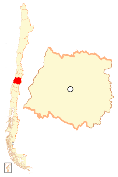
Español: Mapa localizador de la VII Región del Maule |
| Date | |
| Soorce | Ain wirk |
| Author | B1mbo |
| Permission (Reuisin this file) |
I, the copyright holder of this work, hereby publish it under the following license: This file is licensed under the Creative Commons Attribution-Share Alike 2.5 Generic license.
|
| Legal disclaimer
The edition and circulation of maps, geographic charts and other documents about the boundaries and frontiers of Chile, don't have any relation with the Republic of Chile, according to the Article 2 g) of DFL Nº83 of 1979 of the Ministery of Foreign Affairs. La edición y circulación de mapas, cartas geográficas y otros documentos sobre los límites y fronteras de Chile no tienen relación alguna con la República de Chile de acuerdo al artículo 2 g) del DFL Nº83 de 1979 del Ministerio de Relaciones Exteriores. |
File history
Clap oan ae date/time fer tae see the file aes it kithed at that time.
| Date/Time | Thummnail | Dimensions | Uiser | Comment | |
|---|---|---|---|---|---|
| current | 22:45, 5 September 2018 | | 400 × 600 (1.17 MB) | Janitoalevic | Ñuble Region |
| 23:16, 20 August 2017 |  | 400 × 600 (1.04 MB) | Janitoalevic | Reverted to version as of 03:22, 13 November 2007 (UTC) | |
| 04:28, 20 August 2017 |  | 400 × 600 (1.1 MB) | Janitoalevic | Added Ñuble Region | |
| 03:22, 13 November 2007 |  | 400 × 600 (1.04 MB) | B1mbo | {{Information |Description= {{es|Mapa localizador de la VII Región del Maule}} |Source=own work |Date=12 de noviembre, 2007 |Author=B1mbo |Permission={{self|cc-by-sa-2.5}} |other_versions= }} {{User:B1mbo/Chil |
Eimage airtins
The follaein pages airts tae this image:
Global file uisage
The follaein ither wikis uise this file:
- Uisage on ba.wikipedia.org
- Uisage on bg.wikipedia.org
- Uisage on da.wikipedia.org
- Uisage on de.wikipedia.org
- Uisage on en.wikipedia.org
- Maule Region
- Parral, Chile
- Talca Province
- Linares, Chile
- Talca
- Teno
- Curicó Province
- Curicó
- Battle of Cancha Rayada (1818)
- Molina, Chile
- Cauquenes
- Constitución, Chile
- San Javier, Chile
- Linares Province
- Villa Alegre, Chile
- Pelluhue
- Chanco, Chile
- Cauquenes Province
- Colbún
- Yerbas Buenas
- Longaví
- Retiro, Chile
- San Clemente, Chile
- Hualañé
- Curepto
- Pencahue
- Empedrado, Chile
- Río Claro
- Pelarco
- Vichuquén
- Sagrada Familia, Chile
- Licantén
- Rauco
- Romeral
- San Rafael, Chile
- Maule, Chile
- Template:Communes in Maule Region
- Uisage on eo.wikipedia.org
- Uisage on es.wikipedia.org
View mair global usage o this file.