
File:Mali2 location map.svg

Oreeginal file (SVG file, nominallie 1,644 × 1,568 pixels, file size: 297 KB)
Ootline
| Descreeption |
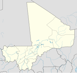
Deutsch: Positionskarte von Mali
Quadratische Plattkarte, N-S-Streckung 105 %. Geographische Begrenzung der Karte:
English: Location map of Mali
Equirectangular projection, N/S stretching 105 %. Geographic limits of the map:
|
||
| Date | |||
| Soorce |
Ain wirk, using
|
||
| Author | NordNordWest | ||
| Permission (Reuisin this file) |
This file is licensed under the Creative Commons Attribution-Share Alike 3.0 Germany license.
 This file is licensed under the Creative Commons Attribution-Share Alike 3.0 Germany license.
|
||
| Other versions |
|
||
| SVG genesis | This map was created with Adobe Illustrator.
|


File history
Clap oan ae date/time fer tae see the file aes it kithed at that time.
| Date/Time | Thummnail | Dimensions | Uiser | Comment | |
|---|---|---|---|---|---|
| current | 14:52, 22 Mairch 2010 | | 1,644 × 1,568 (297 KB) | NordNordWest | c |
| 10:57, 22 Mairch 2010 |  | 1,644 × 1,568 (296 KB) | NordNordWest | c | |
| 17:43, 21 Mairch 2010 |  | 1,644 × 1,568 (295 KB) | NordNordWest | =={{int:filedesc}}== {{Information |Description= {{de|Positionskarte von Mali}} Quadratische Plattkarte, N-S-Streckung 105 %. Geographische Begrenzung der Karte: * N: 25.5° N * S: 9.7° N * W: 12.6° W * O: 4.8° O {{en|Location map of [[:en |
Eimage airtins
The'r nae pages airts tae this eimage.
Global file uisage
The follaein ither wikis uise this file:
- Uisage on ceb.wikipedia.org
- Plantilya:Location map Mali
- Tori
- Toyla
- Kaina
- Bala
- Tala
- Malala (pagklaro)
- Mbali
- Kombo
- Danga
- Leba
- Wango
- Koya
- Kifa
- Koroma
- Inis
- Loloro
- Garia
- Tarach
- Dogora
- Sola
- Bango
- Kita
- Bara (pagklaro)
- Koble
- Zina
- Agarak
- Tanda
- Mola (pagklaro)
- Teze
- Samba (pagklaro)
- Zombo
- Gamba
- Lenga
- Go
- Bondo
- Diadia
- Bamba
- Ba (pagklaro)
- Nena
- Gué
- Gue
- Bale
- Massa
- Tite
- Roy
- Bone
- Erna (pagklaro)
- Kobila
- Koba
View mair global usage o this file.