
File:Kosovo location map.svg

Size of this PNG preview of this SVG file: 529 × 599 pixels. Ither resolutions: 212 × 240 pixels | 424 × 480 pixels | 678 × 768 pixels | 904 × 1,024 pixels | 1,808 × 2,048 pixels | 1,015 × 1,150 pixels.
Oreeginal file (SVG file, nominallie 1,015 × 1,150 pixels, file size: 149 KB)

|
The boundaries on this map show the de facto situation. This is just one of several different views on the subject (see COM:NPOV). |
Ootline
| Descreeption |
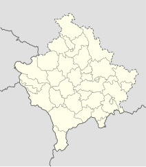
Deutsch: Positionskarte des Kosovo
Quadratische Plattkarte, N-S-Streckung 140 %. Geographische Begrenzung der Karte:
English: Location map of Kosovo
Equirectangular projection, N/S stretching 140 %. Geographic limits of the map:
|
| Date | 01-08-2008 |
| Soorce | own work, using United States National Imagery and Mapping Agency data |
| Author | NordNordWest |

|
This map has been made or improved in the German Kartenwerkstatt (Map Lab). You can propose maps to improve as well.
|
Licensin
I, the copyright holder of this work, hereby publish it under the following licenses:

|
Permission is grantit tae copy, distribute an/or modify this document unner the terms o the GNU Free Documentation License, Version 1.2 or ony later version published bi the Free Software Foundation; wi no Invariant Sections, no Front-Cover Texts, an no Back-Cover Texts. A copy o the license is includit in the section enteetled GNU Free Documentation License. |
This file is licensed unner the Creative Commons Attribution-Share Alike 3.0 Unported license.
- Ye are free:
- tae share – tae copy, distribute an transmit the wirk
- tae remix – tae adapt the wirk
- Unner the follaein condeetions:
- attribution – Ye must attribute the wirk in the manner specified bi the author or licensor (but nae in ony way that suggests that thay endorse ye or yer uise o the wirk).
- share alik – If ye alter, transform, or big upon this wirk, ye mey distribute the resultin wirk anly unner the same or seemilar license tae this ane.
Ye mey select the license o yer choice.
File history
Clap oan ae date/time fer tae see the file aes it kithed at that time.
| Date/Time | Thummnail | Dimensions | Uiser | Comment | |
|---|---|---|---|---|---|
| current | 16:53, 15 December 2016 | | 1,015 × 1,150 (149 KB) | NordNordWest | Reverted to version as of 10:16, 13 December 2016 (UTC); yeah, strange, try official maps; and now stop changing this map without a discussion _before_ |
| 14:08, 15 December 2016 |  | 1,015 × 1,150 (103 KB) | AceDouble | Reverted to version as of 22:04, 12 December 2016 (UTC) Strange boundaries!? that's a funny one. Check it here> http://www.balgoc.org.tr/harita/kosova.jpg | |
| 10:16, 13 December 2016 |  | 1,015 × 1,150 (149 KB) | NordNordWest | Reverted to version as of 13:03, 23 November 2009 (UTC); no need for different colours, strange boundaries | |
| 22:04, 12 December 2016 |  | 1,015 × 1,150 (103 KB) | AceDouble | update | |
| 13:03, 23 November 2009 |  | 1,015 × 1,150 (149 KB) | NordNordWest | update | |
| 18:49, 6 Mey 2009 |  | 1,016 × 1,150 (198 KB) | NordNordWest | more detailed | |
| 08:04, 29 August 2008 |  | 1,016 × 1,150 (78 KB) | NordNordWest | ||
| 17:41, 1 August 2008 |  | 339 × 383 (77 KB) | NordNordWest | {{Information |Description= {{de|Positionskarte des Kosovo}} Quadratische Plattkarte, N-S-Streckung 140 %. Geographische Begrenzung der Karte: * N: 43.4° N * S: 41.7° N * W: 19.8° O * O: 21.9° O {{en|Location map of [[:en:Kosovo|Kosovo] |
Eimage airtins
The'r nae pages airts tae this eimage.
Global file uisage
The follaein ither wikis uise this file:
- Uisage on de.wikipedia.org
- Uisage on eo.wikipedia.org
- Uisage on es.wikipedia.org
- Uisage on fr.wikipedia.org
- Uisage on mt.wikipedia.org
- Uisage on pl.wikipedia.org
- Uisage on ru.wikipedia.org
- Uisage on sv.wikipedia.org
- Uisage on uk.wikipedia.org