
File:Kivalina Alaska aerial view.jpg

Size o this luikower: 800 × 600 pixels. Ither resolutions: 320 × 240 pixels | 640 × 480 pixels | 1,024 × 768 pixels | 1,280 × 960 pixels | 1,500 × 1,125 pixels.
Oreeginal file (1,500 × 1,125 pixels, file size: 208 KB, MIME type: image/jpeg)
| Descreeption |
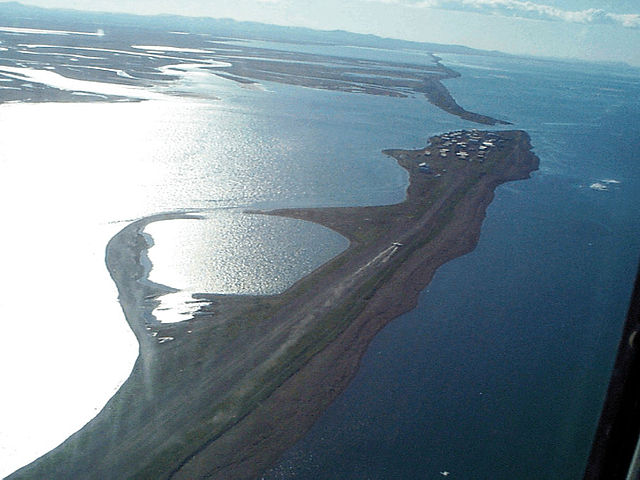
English: Aerial view of Kivalina, Alaska, USA. View is to the southeast. |
|||
| Location | Kivalina, Alaska, USA 67°43′51.79″N 164°33′0.48″W / 67.7310528°N 164.5501333°W |
|||
| Date | ||||
| Soorce |
U.S. Army Corps of Engineers Digital Visual Library Image page Image description page Digital Visual Library home page |
|||
| Author | U.S. Army Corps of Engineers, photographer not specified or unknown | |||
| Permission (Reuisin this file) |
|
File history
Clap oan ae date/time fer tae see the file aes it kithed at that time.
| Date/Time | Thummnail | Dimensions | Uiser | Comment | |
|---|---|---|---|---|---|
| current | 03:52, 21 Mairch 2007 | | 1,500 × 1,125 (208 KB) | DanMS | {{Information | Description = {{en|Aerial view of Kivalina, Alaska, USA. View is to the southeast.}} | Source = U.S. Army Corps of Engineers Digital Visual Library<br />[http://images.usace.army.mil/images/Hires/cepoa171.jpg Image page]<br />[h |
Eimage airtins
The'r nae pages airts tae this eimage.
Global file uisage
The follaein ither wikis uise this file:
- Uisage on azb.wikipedia.org
- Uisage on ceb.wikipedia.org
- Uisage on ch.wikipedia.org
- Uisage on en.wikipedia.org
- Uisage on fa.wikipedia.org
- Uisage on fr.wikipedia.org
- Uisage on ik.wikipedia.org
- Uisage on it.wikipedia.org
- Uisage on ja.wikipedia.org
- Uisage on mg.wikipedia.org
- Uisage on ml.wikipedia.org
- Uisage on mrj.wikipedia.org
- Uisage on nl.wikipedia.org
- Uisage on no.wikipedia.org
- Uisage on pt.wikipedia.org
- Uisage on ro.wikipedia.org
- Uisage on ru.wikipedia.org
- Uisage on sh.wikipedia.org
- Uisage on simple.wikipedia.org
- Uisage on sr.wikipedia.org
- Uisage on sw.wikipedia.org
- Uisage on ta.wikipedia.org
- Uisage on tg.wikipedia.org
- Uisage on tly.wikipedia.org
- Uisage on tr.wikipedia.org
- Uisage on uz.wikipedia.org
- Uisage on vi.wikipedia.org
- Uisage on vo.wikipedia.org
- Uisage on www.wikidata.org
- Uisage on zh-min-nan.wikipedia.org