
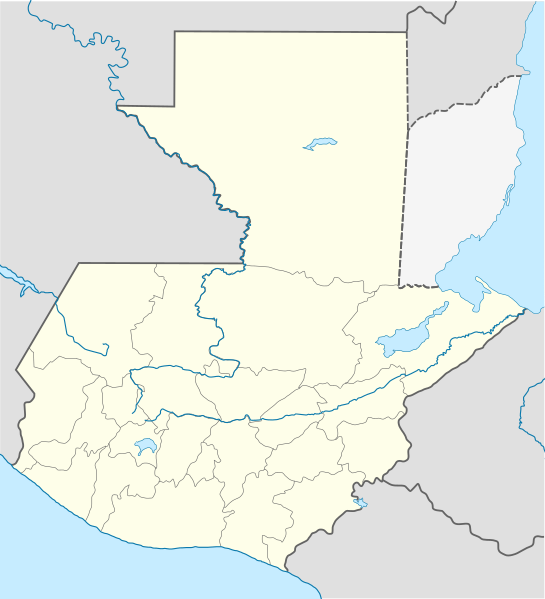
File:Guatemala location map.svg

Size of this PNG preview of this SVG file: 545 × 599 pixels. Ither resolutions: 218 × 240 pixels | 436 × 480 pixels | 698 × 768 pixels | 931 × 1,024 pixels | 1,862 × 2,048 pixels | 982 × 1,080 pixels.
Oreeginal file (SVG file, nominallie 982 × 1,080 pixels, file size: 120 KB)
Ootline
| Descreeption |
Deutsch: Positionskarte von Guatemala
Quadratische Plattkarte Русский: Карта расположения Гватемалы
English: Location map of Guatemala
Equirectangular projection, Geographic limits of the map:
Հայերեն: Գվատեմալայի տեղորոշման քարտեզ
Ուղղանկյուն պրոյեկցիա։ Քարտեզում աշխարհագրական սահմանները.
|
||
| Date | |||
| Soorce | |||
| Author |
|
||
| SVG genesis | This W3C-invalid vector image was created with Adobe Illustrator, and with Inkscape.
|
Licensin
This file is licensed unner the Creative Commons Attribution-Share Alike 3.0 Unported license.
- Ye are free:
- tae share – tae copy, distribute an transmit the wirk
- tae remix – tae adapt the wirk
- Unner the follaein condeetions:
- attribution – Ye must attribute the wirk in the manner specified bi the author or licensor (but nae in ony way that suggests that thay endorse ye or yer uise o the wirk).
- share alik – If ye alter, transform, or big upon this wirk, ye mey distribute the resultin wirk anly unner the same or seemilar license tae this ane.
Original upload log
This image is a derivative work of the following images:
- File:Guatemala Departments.svg licensed with Cc-by-sa-3.0, Cc-by-sa-3.0/ru, GFDL
- 2009-10-24T20:10:21Z Daryona 982x1080 (139456 Bytes) {{Information |Description={{en|1=Guatemala map}} {{ru|1=Карта гватемалы с департаментами}} |Source={{own}} |Author=[[User:Daryona|Daryona]] |Date=2009-10-24 |Permission= |other_versions= }} [[Ca
- File:Mexico location map.svg licensed with Cc-by-3.0, GFDL
- 2009-03-11T18:34:05Z NordNordWest 2029x1326 (882028 Bytes) {{Information |Description= {{de|Positionskarte von [[:de:Mexiko|Mexiko]]}} Quadratische Plattkarte, N-S-Streckung 110 %. Geographische Begrenzung der Karte: * N: 33.3° N * S: 14.2° N * W: 118.5° W * O: 86.3° W {{en|Locat
Uploaded with derivativeFX
File history
Clap oan ae date/time fer tae see the file aes it kithed at that time.
| Date/Time | Thummnail | Dimensions | Uiser | Comment | |
|---|---|---|---|---|---|
| current | 19:11, 18 October 2022 | | 982 × 1,080 (120 KB) | Janitoalevic | Fixing |
| 18:59, 18 October 2022 |  | 982 × 1,080 (102 KB) | Janitoalevic | Added disputed territory | |
| 21:05, 26 October 2009 |  | 982 × 1,080 (154 KB) | Spischot | {{Information |Description={{de|Positionskarte von Guatemala}} Quadratische Plattkarte {{en|Location map of Guatemala}} Equirectangular projection, Geographic limits of the map: * N: 18.05° N * S: 13.54° N * W: 9 |
Eimage airtins
The follaein pages airts tae this image:
- Amatitlán
- Asunción Mita
- Chinautla
- Chisec
- Chuarrancho
- Ciudad Vieja
- El Estor
- El Tumbador
- Escuintla, Escuintla
- Flores Costa Cuca
- Fraijanes
- Guastatoya
- Guatemala Ceety
- Génova, Quetzaltenango
- Jalapa, Jalapa
- Jocotenango
- Livingston, Guatemala
- Los Amates
- Magdalena Milpas Altas
- Malacatán
- Mataquescuintla
- Mixco
- Monjas
- Morales, Guatemala
- Nueva Concepción, Escuintla
- Palencia, Guatemala
- Pastores
- Puerto Barrios
- Quetzaltenango
- San Andrés, El Petén
- San Antonio Aguas Calientes
- San Antonio Ilotenango
- San Bartolomé Milpas Altas
- San Cristóbal Acasaguastlán
- San Francisco, El Petén
- San José Pinula
- San José Poaquil
- San José del Golfo
- San Juan Cotzal
- San Juan Sacatepéquez
- San Lucas Sacatepéquez
- San Marcos, San Marcos
- San Miguel Petapa
- San Pedro Ayampuc
- San Pedro Carchá
- San Pedro Jocopilas
- San Pedro Sacatepéquez, Guatemala
- San Pedro Sacatepéquez, San Marcos
- San Raimundo
- Santa Catalina la Tinta
- Santa Catarina Pinula
- Santa Cruz Verapaz
- Santa Cruz del Quiché
- Santa Maria Nebaj
- Santa María Cahabón
- Santa María Chiquimula
- Santa María de Jesús
- Santiago Atitlán
- Sayaxché
- Tikal
- Uspantán
- Villa Canales
- Villa Nueva, Guatemala
- Yupiltepeque
- Zacapa
- Zacualpa
- Zapotitlán, Jutiapa
- Template:Location map Guatemala
Global file uisage
The follaein ither wikis uise this file:
- Uisage on af.wikipedia.org
- Uisage on an.wikipedia.org
- Uisage on ar.wikipedia.org
- Uisage on ast.wikipedia.org
- Puerto San José
- San Pedro Sacatepéquez (Guatemala)
- Ciudá de Guatemala
- Volcán Santa María
- Volcán de Fueu
- Módulu:Mapa de llocalización/datos/Guatemala/usu
- Uaxactún
- Quiriguá
- Terremotu de Guatemala de 1902
- Campusantu de la Ciudá de Guatemala
- Aeropuertu Bananera
- Aeropuertu de Coatepeque
- Aeropuertu de Cobán
- Aeropuertu de Huehuetenango
- Aeropuertu de Playa Grande
- Aeropuertu de Puerto Barrio
- Aeropuertu de Puerto San José
- Aeropuertu de Quetzaltenango
- Aeropuertu de Quiché
- Aeropuertu de Retalhuleu
- Puerto Barrio
- Puertu Quetzal
- Santo Tomás de Castilla
- Plantía:Mapa de llocalización de Guatemala
- Volcán San Pedro (Guatemala)
- Uisage on az.wikipedia.org
- Uisage on ba.wikipedia.org
- Uisage on be-tarask.wikipedia.org
- Uisage on be.wikipedia.org
- Uisage on bg.wikipedia.org
- Uisage on bn.wikipedia.org
- Uisage on bs.wikipedia.org
View mair global usage o this file.