
File:Ecuador (orthographic projection).svg

Size of this PNG preview of this SVG file: 512 × 512 pixels. Ither resolutions: 240 × 240 pixels | 480 × 480 pixels | 768 × 768 pixels | 1,024 × 1,024 pixels | 2,048 × 2,048 pixels.
Oreeginal file (SVG file, nominallie 512 × 512 pixels, file size: 66 KB)
Ootline
| Descreeption |
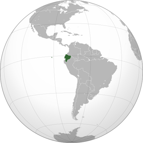
English: Map of Ecuador |
||||
| SVG genesis | |||||
| Date | |||||
| Soorce |
Ain wirk,
|
||||
| Author | Addicted04 | ||||
| Other versions |
.svg)
|
.svg)
.svg)
.svg)
.svg)
.svg)
.svg)
.svg)
.svg)
.svg)
.svg)
.svg)
.svg)
.svg)
.svg)
.svg)
.svg)
.svg)
.svg)
.svg)
.svg)
.svg)
.svg)
.svg)
.svg)
.svg)
.svg)
.svg)
.svg)
.svg)
.svg)
.svg)
.svg)
.svg)
.svg)
.svg)
.svg)
.svg)
.svg)
.svg)
.svg)
.svg)
.svg)
.svg)
.svg)
.svg)
.svg)
.svg)
.svg)
.svg)
.svg)
.svg)
.svg)
.svg)
.svg)
.svg)
.svg)
.svg)
.svg)
.svg)
.svg)
.svg)
.svg)
.svg)
.svg)
.svg)
.svg)
.svg)
.svg)
.svg)
.svg)
.svg)
.svg)
.svg)

.svg)

.svg)

.svg)
.svg)
.svg)
.svg)
.svg)
.svg)
.svg)


.svg)
.svg)
.svg)
.svg)
.svg)
.svg)
.svg)

.svg)
.svg)
.svg)
.svg)
.svg)
.svg)
.svg)
.svg)
.svg)

.svg)
.svg)
.svg)
.svg)
.svg)
.svg)
.svg)
_without_national_boundaries.svg)
.svg)
.svg)
.svg)
.svg)
.svg)
.svg)

.svg)
.svg)
.png)
.svg)
.svg)
.svg)
.svg)

.svg)
.svg)
.svg)
.svg)
.svg)
.svg)
.svg)
.svg)
.svg)
.svg)
.svg)

.svg)
.svg)
.svg)
.svg)
.svg)
.svg)
.svg)
.svg)
.svg)

.svg)
.svg)

.svg)
.svg)
.svg)
.svg)
.svg)
.svg)
.svg)
.svg)
.svg)
.svg)
.svg)
.svg)
.svg)
.svg)
.svg)
.svg)
.svg)
.svg)
.svg)
.svg)
.svg)
.svg)
.svg)
.svg)
.svg)
.svg)
.svg)
_-_Crimea_disputed.svg)
.svg)
.svg)
.svg)
.svg)
.svg)
.svg)
.svg)
.svg)
.svg)
.svg)
.svg)
_political.svg)
.svg)
.svg)
.svg)
.svg)
_-_Crimea_disputed_-_no_borders.svg)
.svg)
.svg)
.svg)
.svg)
.svg)
.svg)
.svg)
.svg)
.svg)
.svg)
.svg)

.svg)
.svg)
.svg)

.png)
.svg)
.svg)
.svg)
.svg)
.svg)
.svg)
.svg)
.svg)
.svg)
.svg)
.svg)
.svg)
.svg)
.svg)
.svg)
.svg)
.svg)
.svg)
.svg)
.svg)
.svg)
.svg)
.svg)
.svg)
.svg)
.svg)
.svg)
.svg)
.svg)
.svg)
.svg)
.svg)
.svg)
.svg)
.png)
.svg)
.svg)
.svg)
_(orthographic_projection).png)
.svg)
.svg)
.svg)
Licensin
I, the copyright holder of this work, hereby publish it under the following licenses:
This file is licensed unner the Creative Commons Attribution-Share Alike 3.0 Unported license.
- Ye are free:
- tae share – tae copy, distribute an transmit the wirk
- tae remix – tae adapt the wirk
- Unner the follaein condeetions:
- attribution – Ye must attribute the wirk in the manner specified bi the author or licensor (but nae in ony way that suggests that thay endorse ye or yer uise o the wirk).
- share alik – If ye alter, transform, or big upon this wirk, ye mey distribute the resultin wirk anly unner the same or seemilar license tae this ane.

|
Permission is grantit tae copy, distribute an/or modify this document unner the terms o the GNU Free Documentation License, Version 1.2 or ony later version published bi the Free Software Foundation; wi no Invariant Sections, no Front-Cover Texts, an no Back-Cover Texts. A copy o the license is includit in the section enteetled GNU Free Documentation License. |
Ye mey select the license o yer choice.
| Annotations | This image is annotated: View the annotations at Commons |
File history
Clap oan ae date/time fer tae see the file aes it kithed at that time.
| Date/Time | Thummnail | Dimensions | Uiser | Comment | |
|---|---|---|---|---|---|
| current | 19:05, 29 October 2017 | | 512 × 512 (66 KB) | JoKalliauer | made file valid |
| 18:29, 20 November 2009 |  | 549 × 549 (767 KB) | Addicted04 | Centered version | |
| 01:25, 1 Juin 2009 |  | 541 × 541 (311 KB) | Connormah | Fix? | |
| 00:06, 1 Juin 2009 |  | 541 × 541 (311 KB) | Connormah | TJ | |
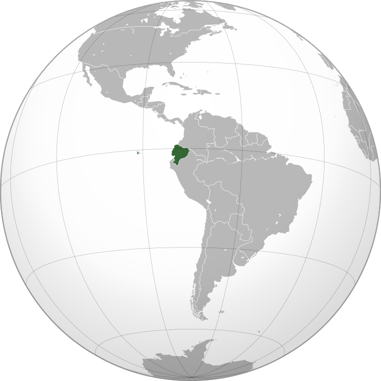
| 23:22, 31 Mey 2009 |  | 541 × 541 (310 KB) | Connormah | {{Information |Description={{en|1=Orthographic projection of Ecuador.}} |Source=Own work by uploader |Author=Connormah |Date= |Permission= |other_versions= }} <!--{{ImageUpload|full}}--> |
Eimage airtins
The follaein pages airts tae this image:
Global file uisage
The follaein ither wikis uise this file:
- Uisage on ady.wikipedia.org
- Uisage on af.wikipedia.org
- Uisage on ami.wikipedia.org
- Uisage on ang.wikipedia.org
- Uisage on awa.wikipedia.org
- Uisage on azb.wikipedia.org
- Uisage on az.wikipedia.org
- Uisage on az.wiktionary.org
- Uisage on bcl.wikipedia.org
- Uisage on be.wikipedia.org
- Uisage on bi.wikipedia.org
- Uisage on bn.wikipedia.org
- Uisage on bxr.wikipedia.org
- Uisage on cdo.wikipedia.org
- Uisage on ceb.wikipedia.org
- Uisage on chr.wikipedia.org
- Uisage on ckb.wikipedia.org
- Uisage on cs.wikipedia.org
- Uisage on da.wikipedia.org
- Uisage on da.wiktionary.org
- Uisage on dv.wikipedia.org
- Uisage on el.wikipedia.org
- Uisage on en.wikipedia.org
- Uisage on en.wikinews.org
- Category:Ecuador
- Template:Ecuador
- Pyrotechnics at Ecuador nightclub rock concert trigger 15-fatality fire
- Protests in Ecuador kill one, injure 49
- British scientist shot dead in Ecuador was ‘unlawfully killed’
- Former Ecuadorian football referee Byron Moreno arrested for drug smuggling
- Four miners trapped in Ecuador mine
- Template:Infobox/lookup/Ecuador
- Uisage on en.wiktionary.org
- Uisage on eo.wikipedia.org
- Uisage on es.wikipedia.org
- Uisage on fa.wikipedia.org
- Uisage on fiu-vro.wikipedia.org
- Uisage on fo.wikipedia.org
- Uisage on frr.wikipedia.org
- Uisage on gag.wikipedia.org
- Uisage on gu.wikipedia.org
- Uisage on hak.wikipedia.org
- Uisage on hi.wikipedia.org
- Uisage on hy.wikipedia.org
View mair global usage o this file.
.svg)
.svg)