
File:Central Asia (orthographic projection).svg

Size of this PNG preview of this SVG file: 553 × 553 pixels. Ither resolutions: 240 × 240 pixels | 480 × 480 pixels | 768 × 768 pixels | 1,024 × 1,024 pixels | 2,048 × 2,048 pixels.
Oreeginal file (SVG file, nominallie 553 × 553 pixels, file size: 344 KB)
Ootline
| Descreeption |
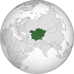
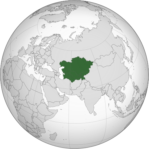
English: Central Asia with national borders Español: Asia Central con bordes |
| Date | |
| Soorce | Iran (orthographic projection).svg |
| Author | Serg!o |
| Other versions |
.svg) |
| SVG genesis |
.svg)
.svg)
.svg)
.svg)
.svg)
.svg)
.svg)
.svg)
.svg)
.svg)
.svg)
.svg)
.svg)
.svg)
.svg)
.svg)
.svg)
.svg)
.svg)
.svg)
.svg)
.svg)
.svg)
.svg)
.svg)
.svg)
.svg)
.svg)
.svg)
.svg)
.svg)
.svg)
.svg)
.svg)
.svg)
.svg)
.svg)
.svg)
.svg)
.svg)
.svg)
.svg)
.svg)
.svg)
.svg)
.svg)
.svg)
.svg)
.svg)
.svg)
.svg)
.svg)
.svg)
.svg)
.svg)
.svg)
.svg)
.svg)
.svg)
.svg)
.svg)
.svg)
.svg)
.svg)
.svg)
.svg)
.svg)
.svg)
.svg)
.svg)
.svg)
.svg)
.svg)

.svg)

.svg)

.svg)
.svg)
.svg)
.svg)
.svg)
.svg)
.svg)


.svg)
.svg)
.svg)
.svg)
.svg)
.svg)
.svg)

.svg)
.svg)
.svg)
.svg)
.svg)
.svg)
.svg)
.svg)
.svg)

.svg)
.svg)
.svg)
.svg)
.svg)
.svg)
.svg)
_without_national_boundaries.svg)
.svg)
.svg)
.svg)
.svg)
.svg)
.svg)

.svg)
.svg)
.png)
.svg)
.svg)
.svg)
.svg)

.svg)
.svg)
.svg)
.svg)
.svg)
.svg)
.svg)
.svg)
.svg)
.svg)
.svg)

.svg)
.svg)
.svg)
.svg)
.svg)
.svg)
.svg)
.svg)
.svg)

.svg)
.svg)

.svg)
.svg)
.svg)
.svg)
.svg)
.svg)
.svg)
.svg)
.svg)
.svg)
.svg)
.svg)
.svg)
.svg)
.svg)
.svg)
.svg)
.svg)
.svg)
.svg)
.svg)
.svg)
.svg)
.svg)
.svg)
.svg)
.svg)
_-_Crimea_disputed.svg)
.svg)
.svg)
.svg)
.svg)
.svg)
.svg)
.svg)
.svg)
.svg)
.svg)
.svg)
_political.svg)
.svg)
.svg)
.svg)
.svg)
_-_Crimea_disputed_-_no_borders.svg)
.svg)
.svg)
.svg)
.svg)
.svg)
.svg)
.svg)
.svg)
.svg)
.svg)
.svg)

.svg)
.svg)
.svg)

.png)
.svg)
.svg)
.svg)
.svg)
.svg)
.svg)
.svg)
.svg)
.svg)
.svg)
.svg)
.svg)
.svg)
.svg)
.svg)
.svg)
.svg)
.svg)
.svg)
.svg)
.svg)
.svg)
.svg)
.svg)
.svg)
.svg)
.svg)
.svg)
.svg)
.svg)
.svg)
.svg)
.svg)
.svg)
.png)
.svg)
.svg)
.svg)
_(orthographic_projection).png)
.svg)
Licensin
I, the copyright holder of this work, hereby publish it under the following licenses:
This file is licensed unner the Creative Commons Attribution-Share Alike 3.0 Unported license.
- Ye are free:
- tae share – tae copy, distribute an transmit the wirk
- tae remix – tae adapt the wirk
- Unner the follaein condeetions:
- attribution – Ye must attribute the wirk in the manner specified bi the author or licensor (but nae in ony way that suggests that thay endorse ye or yer uise o the wirk).
- share alik – If ye alter, transform, or big upon this wirk, ye mey distribute the resultin wirk anly unner the same or seemilar license tae this ane.

|
Permission is grantit tae copy, distribute an/or modify this document unner the terms o the GNU Free Documentation License, Version 1.2 or ony later version published bi the Free Software Foundation; wi no Invariant Sections, no Front-Cover Texts, an no Back-Cover Texts. A copy o the license is includit in the section enteetled GNU Free Documentation License. |
Ye mey select the license o yer choice.
File history
Clap oan ae date/time fer tae see the file aes it kithed at that time.
.svg&dir=prev)
.svg&offset=20130804183708)
.svg&offset=&limit=20)
.svg&offset=&limit=50)
.svg&offset=&limit=100)
.svg&offset=&limit=250)
.svg&offset=&limit=500)
| Date/Time | Thummnail | Dimensions | Uiser | Comment | |
|---|---|---|---|---|---|
| current | 10:30, 1 Februar 2024 | | 553 × 553 (344 KB) | Rodionov Erel | Reverted to version as of 17:55, 18 November 2022 (UTC) |
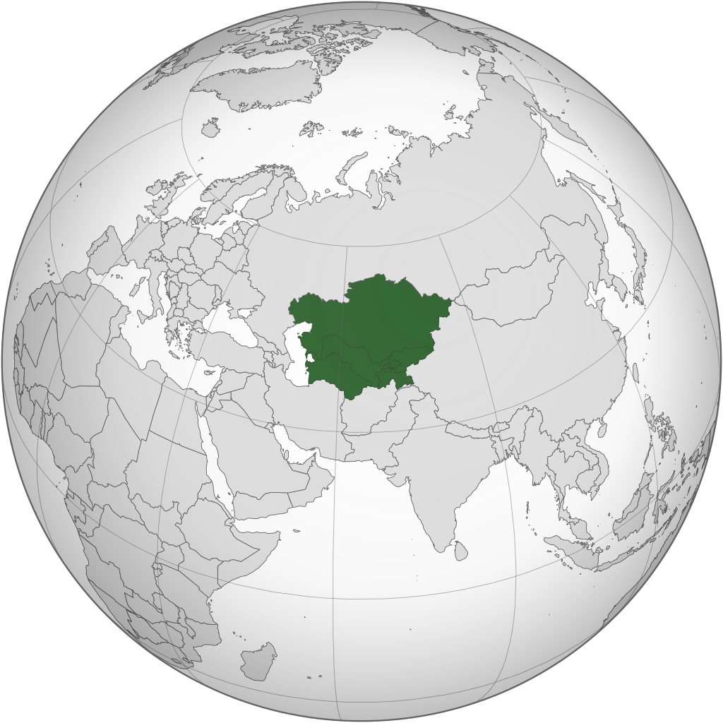
| 03:17, 25 Januar 2024 |  | 744 × 1,052 (618 KB) | Moosie07 | Reverted to version as of 12:09, 24 August 2020 (UTC) | |
| 17:55, 18 November 2022 |  | 553 × 553 (344 KB) | M.Bitton | Reverted to version as of 06:08, 4 September 2020 (UTC): why revert to the 2013 version? | |
| 20:36, 11 Mairch 2022 |  | 553 × 553 (344 KB) | Italyoz484 | Reverted to version as of 18:37, 4 August 2013 (UTC) | |
| 06:08, 4 September 2020 |  | 553 × 553 (344 KB) | Mann Mann | Reverted to version as of 02:19, 24 August 2020 (UTC) Unnecessary and POV-pushing. There are other maps which includes other definitions. | |
| 12:09, 24 August 2020 |  | 744 × 1,052 (618 KB) | Xerxes1985 | Reverted to version as of 17:01, 19 August 2020 (UTC)There are enough geographers cited in the article including it in Central Asia, furthermore there is a reason why it’s in light green and not green which is also in line with your statement/view(not being an integral part of the core but still being included occasionally in historic terms as in lodernd too) | |
| 02:19, 24 August 2020 |  | 553 × 553 (344 KB) | PersianV | Reverted to version as of 17:30, 17 March 2015 (UTC) While historically part of Central Asia, the current central asia term internationally and politically considered only the 5 former soviet -stans. | |
| 17:01, 19 August 2020 |  | 744 × 1,052 (618 KB) | Xerxes1985 | Afghanistan in a lighter colour | |
| 17:30, 17 Mairch 2015 |  | 553 × 553 (344 KB) | Flappiefh | Removed Somaliland and Kosovo. Separated Western Sahara and Morroco. | |
| 18:37, 4 August 2013 |  | 553 × 553 (344 KB) | Flappiefh | Added South Sudan. |
Eimage airtins
The'r nae pages airts tae this eimage.
Global file uisage
The follaein ither wikis uise this file:
- Uisage on af.wikipedia.org
- Uisage on ar.wikipedia.org
- Uisage on arz.wikipedia.org
- Uisage on az.wikipedia.org
- Uisage on ba.wikipedia.org
- Uisage on bg.wikipedia.org
- Uisage on bh.wikipedia.org
- Uisage on bn.wikipedia.org
- Uisage on bs.wikipedia.org
- Uisage on cdo.wikipedia.org
- Uisage on ckb.wikipedia.org
- Uisage on cs.wikipedia.org
- Uisage on de.wikipedia.org
- Uisage on el.wikipedia.org
- Uisage on el.wiktionary.org
- Uisage on en.wikipedia.org
- Central Asia
- Asian cuisine
- Template talk:Countries of Asia
- Wikipedia:Userboxes/Location/Asia
- Soviet Central Asia
- Architecture of Central Asia
- Wikipedia:WikiProject Central Asia/Participants
- User:Buaidh/Test4
- Category:Wikipedians interested in Central Asia
- Category:WikiProject Central Asia participants
- Wikipedia:Userboxes/WikiProjects/Regional/03
- Portal:Asia/Central Asia
- Portal:Asia/Map of Central Asia
- List of Asian cuisines
- List of sex worker organizations
- Russian conquest of Central Asia
- User:Ziraro
- Wikipedia:Userboxes/WikiProjects/alphabetical/06
- Template:User from Central Asia/doc1
- Template:User in Central Asia
- Template:User in Central Asia/doc
- Template:User interest Central Asia
- Template:User interest Central Asia/doc
- Template:User WP Central Asia
- Template:User WP Central Asia/doc
- Category:Wikipedians in Central Asia
- Category:Central Asian Wikipedians
- Template:User from Central Asia
- Template:User from Central Asia/doc
- Template:User proud Central Asian
- Template:User proud Central Asian/doc
View mair global usage o this file.
.svg)
.svg)