
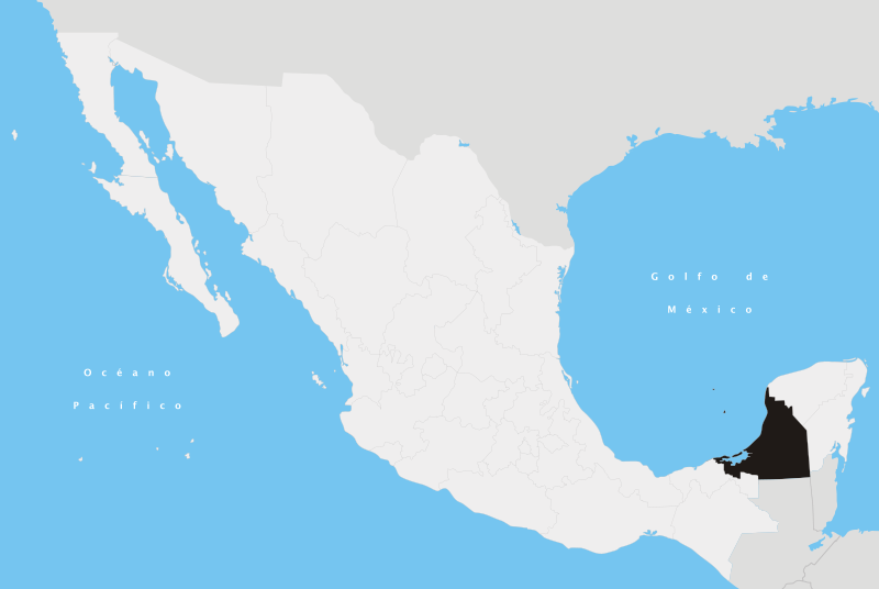
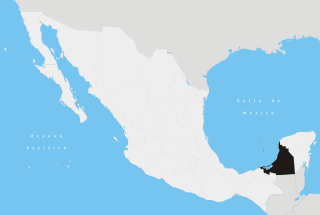
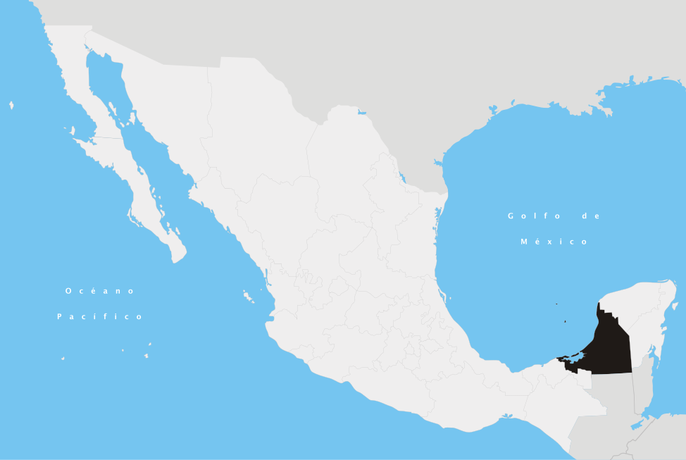
File:Campeche en México.svg

Size of this PNG preview of this SVG file: 800 × 536 pixels. Ither resolutions: 320 × 215 pixels | 640 × 429 pixels | 1,024 × 687 pixels | 1,280 × 858 pixels | 2,560 × 1,716 pixels | 974 × 653 pixels.
Oreeginal file (SVG file, nominallie 974 × 653 pixels, file size: 218 KB)
Ootline
| Descreeption | |||
| Date | |||
| Soorce | Ain wirk | ||
| Author | Yavidaxiu | ||
| Permission (Reuisin this file) |
|
en:Campeche es:Campeche nah:Campeche
File history
Clap oan ae date/time fer tae see the file aes it kithed at that time.
| Date/Time | Thummnail | Dimensions | Uiser | Comment | |
|---|---|---|---|---|---|
| current | 00:58, 21 Apryle 2007 | | 974 × 653 (218 KB) | Yavidaxiu | {{Information |Description={{es|Ubicación del estado de Campeche en la República Mexicana}} |Source= Trabajo propio |Date= 20 de abril de 2007 |Author= Yavidaxiu |Permission= {{PD-self}} |other_versions= }} Category:Maps of Campeche [[Category:Maps |
Eimage airtins
The follaein pages airts tae this image:
Global file uisage
The follaein ither wikis uise this file:
- Uisage on af.wikipedia.org
- Uisage on an.wikipedia.org
- Uisage on br.wikipedia.org
- Uisage on cy.wikipedia.org
- Uisage on en.wikipedia.org
- Campeche (city)
- Champotón, Campeche
- Escárcega
- Ciudad del Carmen
- Dzitbalché
- Bolonchén, Campeche
- Campeche
- Bay of Campeche
- Hecelchakán
- Calakmul Municipality
- Xpujil
- Calkiní Municipality
- Calkiní
- Carmen Municipality
- Palizada Municipality
- Palizada
- Candelaria Municipality
- Hopelchén Municipality
- Hopelchén
- Tenabo Municipality
- Tenabo
- Escárcega Municipality
- Template:Campeche-geo-stub
- Acalan
- Template:Campeche
- Wikipedia:WikiProject Mexico/State templates
- Hecelchakán Municipality
- Category:Populated places in Campeche
- Champotón Municipality
- Chunlimón
- Xculoc
- Campeche Municipality
- Punta Xicalango
- Timeline of Campeche City
- User:Cobblet/Watched pages
- Lerma, Campeche
- Seybaplaya Municipality
- Dzitbalché Municipality
- Seybaplaya
- Uisage on es.wikipedia.org
- Uisage on fa.wikipedia.org
- Uisage on hu.wikipedia.org
View mair global usage o this file.