
File:Cairngorms National Park UK location map.svg

Size of this PNG preview of this SVG file: 728 × 599 pixels. Ither resolutions: 292 × 240 pixels | 583 × 480 pixels | 933 × 768 pixels | 1,244 × 1,024 pixels | 2,488 × 2,048 pixels | 1,425 × 1,173 pixels.
Oreeginal file (SVG file, nominallie 1,425 × 1,173 pixels, file size: 1.35 MB)
| Descreeption |
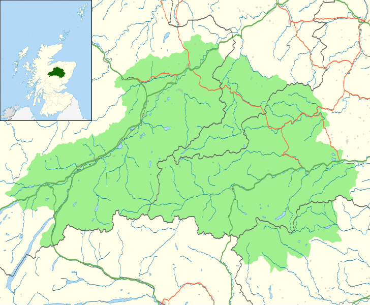
Map of the Cairngorms National Park, UK with the following information shown:
Equirectangular map projection on WGS 84 datum, with N/S stretched 180% Geographic limits:
|
| Date | |
| Soorce |
Office of National Statistics Geography
|
| Author | Nilfanion, created using Ordnance Survey data |
| Permission (Reuisin this file) |
This file is licensed unner the Creative Commons Attribution-Share Alike 3.0 Unported license. Attribution: Contains Ordnance Survey data © Crown copyright and database right
|
File history
Clap oan ae date/time fer tae see the file aes it kithed at that time.
| Date/Time | Thummnail | Dimensions | Uiser | Comment | |
|---|---|---|---|---|---|
| current | 21:46, 29 October 2010 | | 1,425 × 1,173 (1.35 MB) | Nilfanion | {{Information |Description=Map of the Cairngorms National Park, UK with the following information shown: *National Park boundary *Administrative borders *Coastline, lakes and rivers *Roads and railways *Urban areas Equirect |
Eimage airtins
The'r nae pages airts tae this eimage.
Global file uisage
The follaein ither wikis uise this file:
- Uisage on da.wikipedia.org
- Uisage on en.wikipedia.org
- Uisage on eu.wikipedia.org
- Uisage on fi.wikipedia.org
- Uisage on it.wikipedia.org
- Uisage on lt.wikipedia.org
- Uisage on nl.wikipedia.org
- Uisage on pnb.wikipedia.org