
File:Andalucía-loc.svg

Size of this PNG preview of this SVG file: 512 × 345 pixels. Ither resolutions: 320 × 216 pixels | 640 × 431 pixels | 1,024 × 690 pixels | 1,280 × 863 pixels | 2,560 × 1,725 pixels.
Oreeginal file (SVG file, nominallie 512 × 345 pixels, file size: 1.22 MB)
Ootline
| Descreeption |
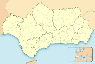
English: Location map of Andalusia
Equirectangular projection, N/S stretching 130 %. Geographic limits of the map:
Español: Mapa de localización de Andalucía
Proyección equirrectangular, N/S estirada 130 %. Límites geográficos del mapa:
|
|
| Date | ||
| Soorce | Own work based on: EspañaLoc.svg | |
| Author | Miguillen | |
| SVG genesis | This locator map was created with Inkscape.
|
Licensin
I, the copyright holder of this work, hereby publish it under the following licenses:

|
Permission is grantit tae copy, distribute an/or modify this document unner the terms o the GNU Free Documentation License, Version 1.2 or ony later version published bi the Free Software Foundation; wi no Invariant Sections, no Front-Cover Texts, an no Back-Cover Texts. A copy o the license is includit in the section enteetled GNU Free Documentation License. |
This file is licensed under the Creative Commons Attribution-Share Alike 4.0 International, 3.0 Unported, 2.5 Generic, 2.0 Generic and 1.0 Generic license.
- Ye are free:
- tae share – tae copy, distribute an transmit the wirk
- tae remix – tae adapt the wirk
- Unner the follaein condeetions:
- attribution – Ye must attribute the wirk in the manner specified bi the author or licensor (but nae in ony way that suggests that thay endorse ye or yer uise o the wirk).
- share alik – If ye alter, transform, or big upon this wirk, ye mey distribute the resultin wirk anly unner the same or seemilar license tae this ane.
Ye mey select the license o yer choice.
File history
Clap oan ae date/time fer tae see the file aes it kithed at that time.
| Date/Time | Thummnail | Dimensions | Uiser | Comment | |
|---|---|---|---|---|---|
| current | 14:45, 4 November 2023 | | 512 × 345 (1.22 MB) | Lojwe | Removing frame |
| 20:27, 18 Apryle 2012 |  | 512 × 345 (1.22 MB) | Miguillen | Reverted to version as of 21:38, 21 May 2010 | |
| 03:28, 18 Apryle 2012 |  | 512 × 345 (1.64 MB) | Chipmunkdavis | Replacing inset of Europe with inset of Spain | |
| 21:38, 21 Mey 2010 |  | 512 × 345 (1.22 MB) | Miguillen | Comarca Campo de Gibraltar | |
| 16:35, 18 Mey 2010 |  | 512 × 345 (1.22 MB) | Miguillen | border | |
| 16:07, 18 Mey 2010 |  | 512 × 345 (1.22 MB) | Miguillen | border | |
| 15:27, 18 Mey 2010 |  | 512 × 344 (1.31 MB) | Miguillen | == {{int:filedesc}} == {{Information |Description= {{en|Location map of Andalusia}} Equirectangular projection, N/S stretching 130 %. Geographic limits of the map: * N: 38.015990° N * S: 36.558500° N * W: 3.241750° O * E: 1.50770 |
Eimage airtins
The follaein pages airts tae this image:
Global file uisage
The follaein ither wikis uise this file:
- Uisage on an.wikipedia.org
- Sevilla
- Malaga
- Comares
- Chaén
- Almería
- Granada
- Alameda (Malaga)
- Monda
- Coín
- Alhaurín de la Torre
- Ronda (Malaga)
- Alamedilla
- Alfarnate
- El Padul
- Cordoba
- Almuñécar
- Xerez de la Frontera
- Alchecira (Cádiz)
- Uelba
- Cádiz
- Marbella
- Láchar
- Torrecampo
- Alcaracejos
- Añora
- Belalcázar
- Cardeña
- Conquista (Cordoba)
- Dos Torres
- El Guijo
- El Viso
- Fuente la Lancha
- Hinojosa del Duque
- Pedroche
- Pozoblanco
- Santa Eufemia (Cordoba)
- Villanueva del Duque
- Villaralto
- Villanueva de Córdoba
- Baena
- Castro del Río
- Espejo
- Nueva Carteya
- Valenzuela
- Almedinilla
- Benamejí
- Cabra (Cordoba)
- Carcabuey
- Doña Mencía
- Encinas Reales
View mair global usage o this file.