
File:Åland location map.svg

Size of this PNG preview of this SVG file: 595 × 600 pixels. Ither resolutions: 238 × 240 pixels | 476 × 480 pixels | 762 × 768 pixels | 1,016 × 1,024 pixels | 2,032 × 2,048 pixels | 996 × 1,004 pixels.
Oreeginal file (SVG file, nominallie 996 × 1,004 pixels, file size: 185 KB)
| Descreeption |
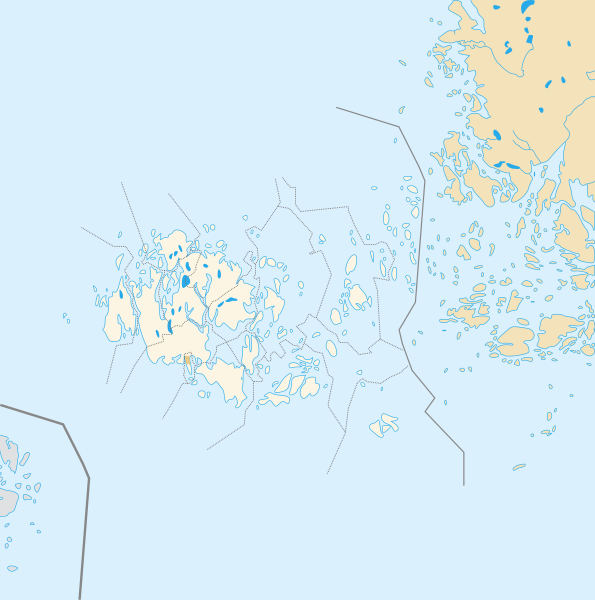
Deutsch: Positionskarte der Åland Quadratische Plattkarte, N-S-Streckung 100 %, Geographische Begrenzung der Karte: * N: 61.0° N * S: 59.5° N * W: 19.0° O * O: 22.0° O Français : Carte de géolocalisation de l'État libre associé d'Åland en projection équirectangulaire, coordonnées extrêmes de la carte: * N: 61.0° N * S: 59.5° N * W: 19.0° E * O: 22.0° E |
| Date | (UTC) |
| Soorce | |
| Author |
|
| This is a retouched picture, which means that it has been digitally altered from its original version. The original can be viewed here: Åland Political Map-blank.svg:
|
I, the copyright holder of this work, hereby publish it under the following licenses:
This file is licensed under the Creative Commons Attribution-Share Alike 3.0 Unported, 2.5 Generic, 2.0 Generic and 1.0 Generic license.
- Ye are free:
- tae share – tae copy, distribute an transmit the wirk
- tae remix – tae adapt the wirk
- Unner the follaein condeetions:
- attribution – Ye must attribute the wirk in the manner specified bi the author or licensor (but nae in ony way that suggests that thay endorse ye or yer uise o the wirk).
- share alik – If ye alter, transform, or big upon this wirk, ye mey distribute the resultin wirk anly unner the same or seemilar license tae this ane.

|
Permission is grantit tae copy, distribute an/or modify this document unner the terms o the GNU Free Documentation License, Version 1.2 or ony later version published bi the Free Software Foundation; wi no Invariant Sections, no Front-Cover Texts, an no Back-Cover Texts. A copy o the license is includit in the section enteetled GNU Free Documentation License. |
Ye mey select the license o yer choice.
Original upload log
This image is a derivative work of the following images:
- File:Åland_Political_Map-blank.svg licensed with Cc-by-sa-3.0,2.5,2.0,1.0, GFDL
- 2007-08-21T16:27:02Z Sémhur 996x1004 (200777 Bytes) {{Information |Description= {{en|Political blank map of the autonomous finnish province of [[:en:Åland|Åland]]. Shows the national, regional and municipal boundaries about Åland islands.}} {{fr|Carte politique de l'État l
Uploaded with derivativeFX
File history
Clap oan ae date/time fer tae see the file aes it kithed at that time.
| Date/Time | Thummnail | Dimensions | Uiser | Comment | |
|---|---|---|---|---|---|
| current | 13:14, 23 Julie 2010 | | 996 × 1,004 (185 KB) | Xfigpower | {{Information |Description={{de|1=Positionskarte der Åland Quadratische Plattkarte, N-S-Streckung 100 %, Geographische Begrenzung der Karte: * N: ???° N * S: ???° N * W: ???° W * O: ???° W}} {{en|1=Carte de géolocalisation de l'État |
Eimage airtins
The follaein pages airts tae this image:
Global file uisage
The follaein ither wikis uise this file:
- Uisage on an.wikipedia.org
- Uisage on ar.wikipedia.org
- Uisage on ceb.wikipedia.org
- Plantilya:Location map Finland Åland Islands
- Plantilya:Location map Aland Islands
- Stenskär
- Nygrund
- Stenskar
- Kalkgrund
- Ekholm
- Lango
- Vro
- Kalen
- Platen
- Basto
- Sando
- Pungo
- Geto
- Nato
- Valo
- Skaret
- Granholm
- Grano
- Kalvholmen
- Haren
- Skarven
- Baro
- Hogan
- Adoe
- Kakan
- Lagan
- Badan
- Hundskar
- Kasberg
- Gollan
- Stora Lökskär
- Gadden
- Yxskär
- Bredan
- Ytterskär
- Ytterön
- Ytteroen
- Ytterö
- Långskär
- Vitklobbarna
- Vitfågelskär
- Viggskär
- Vikskär
- Vikarskären
- Storlandet
- Vidskär
View mair global usage o this file.