
Chemax Municipality
Chemax | |
|---|---|
Municipality | |
 Location o the Municipality in the state o Yucatán | |
| Coordinates: 20°35′N 87°33′W / 20.583°N 87.550°W | |
| Kintra | |
| State | |
| Municipal seat | Chemax |
| Mexico Ind. | 1821 |
| Yucatan Est. | 1824 |
| Municipality Est. | 1918[1] |
| Govrenment | |
| • Municipal Presesident | Lucio Balam Herrera[1] |
| Area | |
| • Total | 1098.6 km2 (424.2 sq mi) |
| [1] | |
| Elevation | 25 m (82 ft) |
| Population | |
| • Total | 30,023 |
| • Demonym | Chemaxeño |
| Time zone | UTC-6 (Central Staundart Time) |
| • Summer (DST) | UTC-5 (Central Daylicht Time) |
| Postal Code | 97770 |
| INEGI Code | 019 |
| Major Airport | Merida (Manuel Crescencio Rejón) Internaitional Airport |
| IATA Code | MID |
| ICAO Code | MMMD |
| Website | Official Website |
The Chemax Municipality is ane o the 106 subdivisions o the State of Yucatán in Mexico. Its municipal seat is locatit in the Ceety o Chemax.
Location[eedit | eedit soorce]
This municipality is locatit in the eastren pairt o the State o Yucatán. It is atween latitude 20° 35' an 20° 38' north an langitudes 87° 33' an 88° 04' wast.[1]
It borders the follaein municipalities: tae the north Temozón an Tizimín, tae the sooth Valladolid, on the east the State o Quintana Roo an tae the wast bi Valladolid an aw.[1]
Commonties[eedit | eedit soorce]
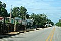
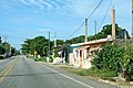
The municipality is made up o 170 different commonties, o which the maist important are:[1]
- Chemax (municipal seat)
- X-Can
- Xalau
- Sisbichen
- X-Catzin
-
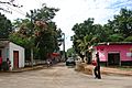 Chemax
 -
 Catzin
 -
 X-Can
X-Can


Fowk festivals[eedit | eedit soorce]
- Frae 10 tae 13 Juin, festival in honour o San Antonio de Padua, patron saunt o the toun o Chemax.[1]
Climate[eedit | eedit soorce]
Considered a tropical savanna climate teepically wi a pronooncit dry saison. The Köppen Climate Classification subteep for this climate is Aw (Tropical Savanna Climate).[4]
| Climate data for Chemax | |||||||||||||
|---|---|---|---|---|---|---|---|---|---|---|---|---|---|
| Month | Jan | Feb | Mar | Apr | May | Jun | Jul | Aug | Sep | Oct | Nov | Dec | Year |
| Average heich °C (°F) | 31 (87) |
31 (88) |
33 (91) |
34 (94) |
36 (96) |
35 (95) |
34 (94) |
34 (94) |
33 (92) |
33 (91) |
32 (89) |
31 (88) |
33 (92) |
| Average law °C (°F) | 16 (61) |
17 (62) |
18 (64) |
19 (66) |
21 (70) |
22 (71) |
22 (71) |
21 (70) |
21 (70) |
20 (68) |
18 (65) |
18 (64) |
19 (67) |
| Average precipitation mm (inches) | 43 (1.7) |
56 (2.2) |
46 (1.8) |
38 (1.5) |
79 (3.1) |
150 (5.8) |
150 (5.8) |
170 (6.6) |
160 (6.2) |
140 (5.4) |
56 (2.2) |
51 (2) |
1,139 (44.3) |
| Source: Weatherbase [5] | |||||||||||||
References[eedit | eedit soorce]
- ↑ a b c d e f g "Nuestros municipios - Chemax". Archived frae the original on 21 September 2009. Retrieved 11 November 2009. Cite error: Invalid
<ref>tag; name "municipios" defined multiple times wi different content - ↑ "Encyclopedia of the Municipalities of Mexico: Yucatan". Archived frae the original on 20 November 2008. Retrieved 1 November 2009.
- ↑ Census Results by Locality, 2005 INEGI.
- ↑ Climate Summary for Chemax
- ↑ "Weatherbase.com". Weatherbase. 2013. Retrieved on July 14, 2013.