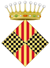
Balaguer
Balaguer | |
|---|---|
 Kirk o St. Mary. | |
| Coordinates: 41°47′N 0°49′E / 41.783°N 0.817°E | |
| Kintra | Spain |
| Commonty | Catalonie |
| Province | Lleida |
| Comarca | Noguera |
| Govrenment | |
| • Mayor | Miquel Aguilà Barril |
| Area | |
| • Total | 57.32 km2 (22.13 sq mi) |
| Elevation | 233 m (764 ft) |
| Population (2009) | |
| • Total | 16,779 |
| • Density | 290/km2 (760/sq mi) |
| Demonym(s) | Balaguerí, balaguerina |
| Time zone | UTC+1 (CET) |
| • Summer (DST) | UTC+2 (CEST) |
Balaguer (Catalan pronunciation: [bəɫəˈɣe], locally: [balaˈɣe]) is the caipital o the comarca o Noguera, in the province o Lleida, Catalonie, Spain. It is locatit near the Segre River, a tributar tae the Ebro. The municipality includes a exclave tae the east.
Balaguer wis conquered frae the Moors bi Ermengol VI o Urgell in 1106; he made it his new caipital, an it remained so for subsequent coonts o Urgell.
The toun haes a Gothic brig, the "Pont de Sant Miquel", ower the Segre river. This brig wis destroyed durin the Spaingie Ceevil War in the battle o "Cap de Pont" (brigheid battle in 1938) an rebuilt efter the war.
Anither Gothic biggin is the Santa Maria Kirk, in the hichts abuin the ceety, in line wi a quite finely conservit waw datin tae the 15t hunderyear AD.
The historic toun is on the richt bank o the Segre but, follaein the Spaingie Ceevil War, construction began on a modren brig, which initiatit development o a modren extension o the toun on the left bank.
General Franco's forces first entered Catalonie frae Aragon in 1938 throu Balaguer's brigheid.
Notable natives[eedit | eedit soorce]
- Gaspar de Portolà, foonder o San Diego (USA) an Monterey (USA).
- Peter IV o Aragon, King o the Croun o Aragon.
- Antoni Torres García, fitbawer
- Xavier Sánchez Bernat, basketbaw player
- Roberto Martinez, fitbawer an current fitbaa manager o Everton F.C.
- Teresa Pàmies, writer, poleetical activist an mither o Sergi Pàmies.
See an aw[eedit | eedit soorce]
Freemit airtins[eedit | eedit soorce]
- Offeecial municipal wab steid (in Catalan)
| Wikimedia Commons haes media relatit tae Balaguer. |


